Smart city pilots run by UTA members, with the solutions and innovators behind them, ready for new cities to replicate and test.
Swipe or use the arrows to browse. Jump to a section with the tabs above.
About UTA
What is UTA?
The Urban Technology Alliance (UTA) is an international non-profit association based in Geneva. It acts as a neutral, trusted intermediary between cities and solution partners. UTA structures real urban challenges, matches them with the right innovators and facilitates pilots, so that cities can test, validate and refine smart city solutions in real-life conditions before large-scale deployment.
Welcome
Cities do not need more promises about technology. They need evidence. UTA gives cities a neutral place to test smart city solutions in real streets, parks, homes and neighbourhoods before they commit to large-scale deployment. This catalogue brings together pilots run by our members across Europe, Japan and the United States, the solutions they tested and the organisations behind them. Some are recent; others laid the foundations years ago. All of them carry lessons other cities can reuse. If your city has a challenge it wants to solve, we would like to hear about it.
Dr Levent Gürgen
President, Urban Technology Alliance
About UTA
A neutral and trusted framework
Technology-independentNo preferred vendors or locked ecosystems. We choose solutions for performance, impact and each city’s needs.
Non-profit and neutralUTA acts as a neutral third party serving the public interest.
ScalableWe design pilots so other cities, contexts and regions can replicate them.
BalancedCities, industry, academia and partners have an equal voice.
Science-basedAcademic partners validate KPIs, methods and results.
Open learningsWe share results, KPIs and lessons with the whole ecosystem.
Who UTA is for
Cities- Validate solutions before scaling
- Reduce risk and uncertainty
- Share learnings with peer cities
Industry and startups- Test solutions in real conditions
- Prove impact and performance
- Improve products with city feedback
Academia and non-profits- Apply research to real urban needs
- Contribute to evidence-based pilots
- Access real-world data and insights
Network
UTA ecosystem
30Member organisations
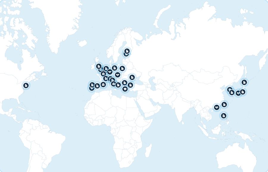
26Member and partner cities
50+Partners
3Continents
20Countries
10+Solution domains demonstrated
18+UTA members in EU project consortia
~24M€Portfolio value across active Horizon Europe projects

Network
Cities
Member cities
Member cities provide real-world testbeds for smart city experimentation and help shape UTA’s work.
Bibai, JapanBucheon, South KoreaBusan, South KoreaCauayan, PhilippinesFujisawa, JapanGrenoble Alpes Métropole, FranceSaitama, JapanSantander, SpainSejong, South KoreaSiheung, South KoreaTaipei, TaiwanTsukuba, Japan
Partner cities
Partner cities support pilot activities and share local insights with the network.
Área Metropolitana de Barcelona, SpainAthens, GreeceBristol, United KingdomChamrousse, FranceChișinău, MoldovaDublin (Fingal), IrelandFlorence, ItalyGenova, ItalyGZM Metropolis, PolandHelsinki, FinlandIstanbul, TürkiyeJena, GermanyMilan, ItalyNew York City, United StatesParis, FranceTampere, FinlandTirana, AlbaniaTrento, ItalyValencia, Spain
Network
Innovators
UTA members include companies, universities and non-profit organisations. They contribute solutions and expertise, run pilots with partner cities and share what they learn with the network. Partner organisations take part in pilots and projects with UTA.
UTA members
KentyouData · France
Data in MotionData · Germany
JrissSystems · Japan
Latitudo 40Data · Italy
NTT EastDigital · Japan
RealSimModelling · Ireland
Caspera LabDigital · France
CrowdScanConnectivity · Belgium
WeMBEnergy · South Korea
KAISTAI · South Korea
Keio UniversityDigital · Japan
Nagoya UniversityMobility · Japan
University of CantabriaDigital · Spain
Czech Smart City ClusterGovernance · Czechia
FeugaData · Spain
IoT LabDigital · Switzerland
Knowledge CapitalMobility · Japan
Urban OpusData · Canada
Partner organisations
Universidade da CoruñaLancaster UniversityUniversity of TsukubaICCS, NTUASmart City Consortium (SCC)InovalléeEIP-SCCEIT Digital CitiesEclipse FoundationGlobal City Teams ChallengeIndustry IoT ConsortiumIoT Acceleration ConsortiumOSGi AllianceOpen Agile Smart CitiesBristol is OpenWorldline
How it works
How UTA works
From city need to proven solution
CitiesIdentify real urban needs and priorities.
ChallengesTurn each need into a concrete problem to solve.
PilotsTest the solution in real-life conditions.
SolutionsProvide a practical answer that can scale.
InnovatorsCompanies, universities and non-profits build and deliver the solution.
From challenge to pilot
- MatchmakingCities publish open challenges. UTA matches them with relevant solution providers and partners.
- Ongoing pilotSolutions run in real urban environments, with continuous coordination and reporting.
- Finalised pilotUTA evaluates, documents and shares the results to support replication and scaling.
How it works
What UTA delivers
Concrete outputs to support decision-making, replication and scaling.
Pilots and testbedsReal-world pilots that run in operational urban environments.
Guidelines and KPIsIndicators and methodologies to measure impact and performance.
Reference architecturesReusable technical and functional frameworks that pilots have validated.
Lessons and best practicesLessons and recommendations drawn from real deployments.
Marketplace and showcaseA curated space where you can explore validated solutions and pilots.

Pilots
Pilots
31 real-world pilots run by UTA cities and innovators in mobility, climate, infrastructure and buildings. Each one shows the challenge a city faced, what it tested and what it achieved.
10Infrastructure
10Mobility
7Climate
4Building
Swipe to read each pilot, or tap “Full pilot” to open its page on the UTA website.
BuildingPilot 1 of 31

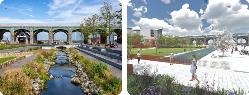
3D and VR planning consultation
Fingal, County Dublin, IrelandFinalisedApril 2020 to September 2026
The challenge
Fingal is consulting residents on large public realm schemes that will reshape its town centres. Technical drawings and one-off public meetings leave many people unable to picture the changes.
What was tested
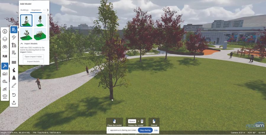
The Council’s Digital Services Department commissioned RealSim to build town-scale digital twins of Balbriggan and Swords. Residents explore proposals at street level, online from any device or on VR headsets in local libraries.
Results
Fingal became the first local authority in Ireland to publish an interactive 3D digital twin online. Two rounds of public consultation shaped the Balbriggan Quay Street and Harbour scheme. Construction runs until September 2026.
Full pilot detailsClimatePilot 2 of 31

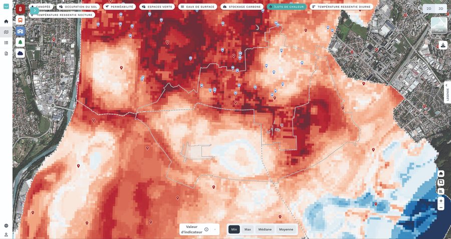
Urban heat islands
Grenoble-Alpes Métropole, FranceFinalisedMarch 2024 to March 2026
The challenge
Grenoble-Alpes Métropole needed a scientifically robust tool that its teams could actually use to understand, anticipate and reduce urban overheating, and to judge the impact of regeneration projects.
What was tested
Within the Climaborough initiative, UTA members Kentyou, Latitudo 40 and RealSim combined satellite Earth observation, AI analytics and a 3D digital twin in one platform. It serves planners and decision-makers, and helps explain choices to citizens.
Results
A consolidated inventory of environmental indicators for the GrandAlpe territory. Side-by-side comparison of urban projects on heat, thermal comfort, vegetation and carbon storage. Scenario simulations to support climate-resilient planning decisions.
Full pilot detailsInfrastructurePilot 3 of 31

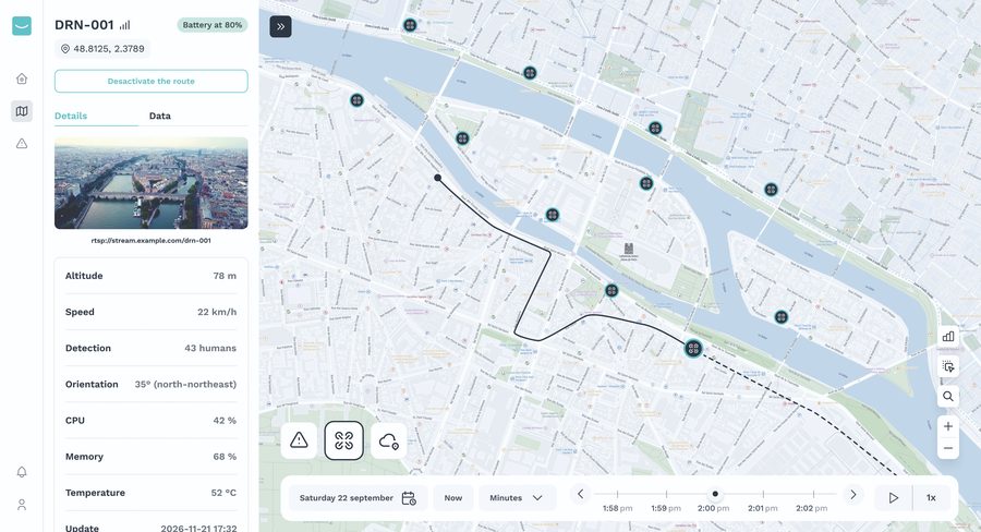
Flood detection and rescue coordination
Paris, FranceFinalisedJune 2024 to December 2025
The challenge
Emergency infrastructure across a city is scattered and runs on mixed hardware. In a major Seine flood, rescue teams need fast, reliable data.
What was tested
A distributed edge-to-cloud platform combined real-time environmental sensors with on-site edge processing, for a Seine flood scenario in Paris-Saclay. Edge sites coordinate themselves and scale with little manual work.
Results
The system detected rising water levels faster and kept emergency teams coordinated across the city.
Full pilot detailsInfrastructurePilot 4 of 31

Telemedicine for remote workers
Athens, GreeceFinalisedJune 2024 to December 2025
The challenge
Hundreds of wind-turbine technicians work on rural and remote sites with poor connectivity, which makes health and safety monitoring difficult.
What was tested
Portable telemedicine units, wearable devices and edge processing delivered secure, real-time patient monitoring without a constant link to a central system.
Results
Emulation with simulated devices showed that the approach can scale to hundreds of sites across Europe.
Full pilot detailsMobilityPilot 5 of 31

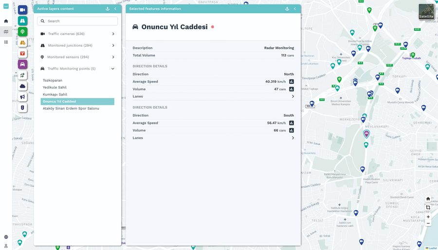
AI-based smart traffic management
Istanbul, Türkiye and Helsinki, FinlandFinalisedJanuary 2024 to June 2025
The challenge
Intersections are bottlenecks for traffic and hotspots for accidents: in Europe, half of urban road deaths happen at them. Istanbul’s operators monitored abnormal traffic by hand, across several separate tools.
What was tested
In the EIT Urban Mobility AI4LIFE project, Kentyou, the City of Istanbul and its municipal company ISBAK integrated ISBAK’s IoT and adaptive signal infrastructure with Kentyou’s AI data platform, adding automatic detection of abnormal traffic and decision-support tools.
Results
Operators receive automatic alerts instead of watching cameras or waiting for citizen calls, so they detect problems and intervene faster. A commercialisation plan prepares roll-out in Europe and beyond.
Full pilot detailsMobilityPilot 6 of 31
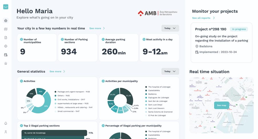
Smart parking management
Barcelona Metropolitan Area (AMB), SpainFinalisedJune to December 2023
The challenge
AMB collected large volumes of data on loading and unloading zones through its logistics app, but could not turn that data into policy or day-to-day decisions.
What was tested
Through the EIT Urban Mobility RAPTOR programme, Kentyou deployed Kentyou Eye, an AI platform with dashboards, forecasting and decision support covering nine municipalities.
Results
Clear visibility of how drivers use loading zones, detection of illegal parking and forecasts of parking availability. In five months, the pilot laid a foundation that other metropolitan areas can replicate.
Full pilot detailsInfrastructurePilot 7 of 31

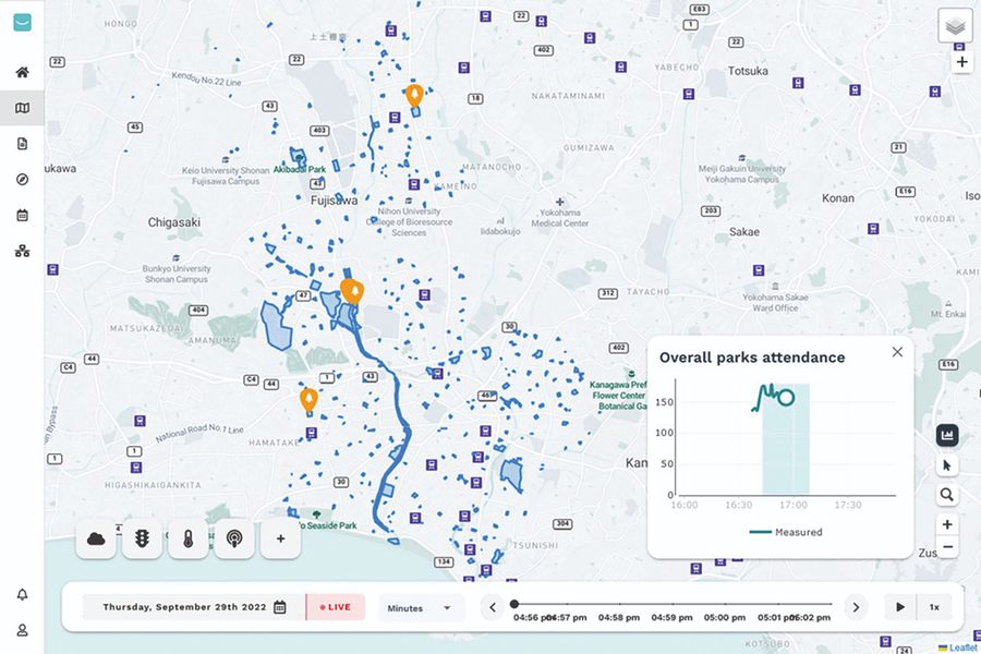
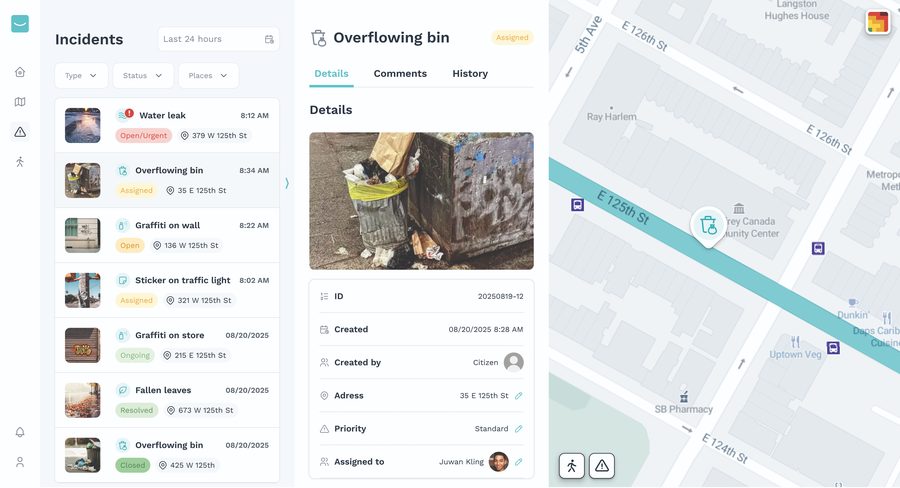
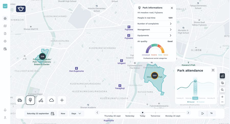
Smart parks monitoring and incident management
Fujisawa, JapanFinalisedJanuary 2022 to June 2023
The challenge
A growing volume of park reports from staff and citizens became hard to track and prioritise.
What was tested
Fujisawa issued the Fujisawa Parks Challenge, and UTA matched the city with Kentyou. Incident reports from a mobile app feed a smart city platform with analytics and dashboards.
Results
Faster response, automatic detection of duplicate and clustered reports, and better planning of repairs and grass cutting. Since March 2022, residents can also report park problems through the city’s official LINE account.
Full pilot detailsMobilityPilot 8 of 31
Smart intersection monitoring
Manhattan, New York City, USAFinalisedJanuary to December 2022
The challenge
Cars, pedestrians, cyclists and e-scooters share the same intersections. Spotting danger in real time needs very low latency, and sending raw video to the cloud raises privacy concerns.
What was tested
Cameras, sensors and machine learning analyse traffic interactions at the roadside. Edge computing processes the video locally and shares only anonymised data with the city’s mobility platform.
Results
Real-time monitoring of risky interactions, lower latency, privacy by design, and a history of traffic behaviour to guide long-term infrastructure planning.
Full pilot detailsInfrastructurePilot 9 of 31
Securing urban sensing and citizen reporting
Fujisawa, JapanFinalisedJuly 2018 to September 2021
The challenge
Fujisawa runs an open sensing platform and invites residents to report on city life by photograph. Both are valuable because they are open, and both expose information that needs protecting.
What was tested
In the EU-Japan M-Sec project, Keio University and NTT East secured the existing sensing fleet end to end and launched SmileCityReport, a photo-reporting app with on-device anonymisation and group-only sharing. Participants traded data through a blockchain marketplace shared with Santander.
Results
250 active users created 1,340 posts. Forty participants in Fujisawa and Santander exchanged 46 posts across the two cities. The team extended sensing to ventilation in restaurants, buses and classrooms.
Full pilot detailsInfrastructurePilot 10 of 31

Secured IoT sensing in a city park
Santander, SpainFinalisedJuly 2018 to September 2021
The challenge
Santander wanted environmental and visitor data from Parque de las Llamas without putting privacy or data integrity at risk.
What was tested
Five sensors measured temperature, humidity, CO₂, volatile organic compounds and noise, and a people counter estimated visitors. The system encrypted the data, recorded its hash on a blockchain and offered it on the M-Sec marketplace.
Results
Nine QR codes let visitors view live readings and rate the park. Eclipse sensiNact handled visualisation and analysis.
Full pilot detailsMobilityPilot 11 of 31

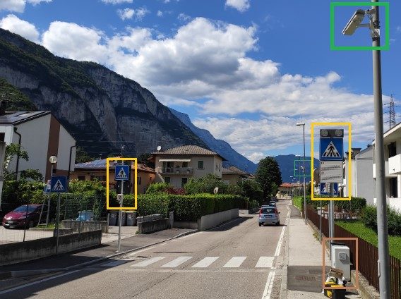
Pedestrian crossing safety
Trento, ItalyFinalisedJuly 2018 to June 2021
The challenge
Pedestrian crossings are among the most dangerous points in a city, and distracted pedestrians make them riskier. Trento wanted real-time risk detection without sending video of citizens to the cloud.
What was tested
In the Horizon 2020 DECENTER project, Kentyou, Fondazione Bruno Kessler, CEA and the Municipality of Trento installed edge-AI cameras at two intersections, built on Eclipse sensiNact, with automatic model updates and a live digital twin of each crossing.
Results
A working prototype on real streets. No raw video leaves the roadside, alerts arrive faster and the approach became the basis for FedIntersect, which extends it to Santander and New York.
Full pilot detailsMobilityPilot 12 of 31

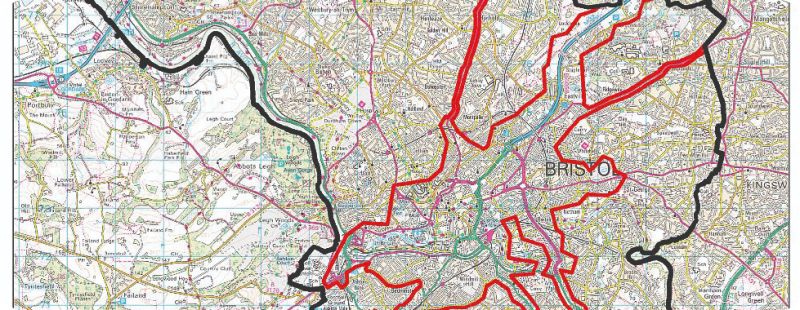
Pollution-aware walking routes
Bristol, United KingdomFinalisedJuly 2016 to June 2019
The challenge
Nitrogen dioxide in central Bristol regularly exceeded legal limits, and a Clean Air Zone was years away. Pedestrians had no way to see which streets were cleaner.
What was tested
In the EU-Japan BigClouT project, Bristol City Council, Bristol is Open and Lancaster University built a routing service that combines pedestrian movement and air-quality data.
Results
Air quality became a routing factor, just as congestion is in mapping apps. Residents and visitors could cut their own exposure straight away, and the same platform served pilots in Grenoble, Fujisawa and Tsukuba.
Full pilot detailsMobilityPilot 13 of 31

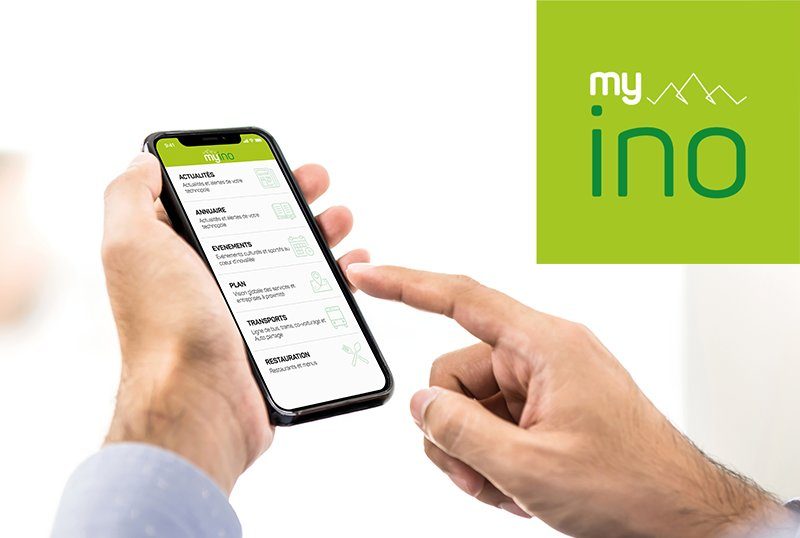
MyIno App for a technology park
Inovallée, Grenoble, FranceFinalisedJuly 2016 to June 2019
The challenge
More than 11,000 people at over 350 companies share buses, canteens and events, but the information sat with separate organisations.
What was tested
Inovallée led the pilot with Grenoble-Alpes Métropole and CEA-Leti. Kentyou’s Eclipse sensiNact aggregates live transport, canteen menus, news, events, a company directory and a map in one app.
Results
The park launched the app on 14 March 2019. Workers downloaded it more than 1,000 times, about one in eleven. The park still runs and develops it.
Full pilot detailsClimatePilot 14 of 31

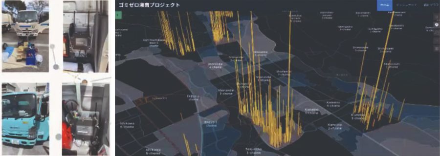
Garbage-truck air-quality sensing
Fujisawa, JapanFinalisedApril 2013 to June 2016
The challenge
Collection routes followed tradition, with no record of actual paths, distances or times. Air quality came from a few fixed stations.
What was tested
Fujisawa City and the ClouT group fitted refuse trucks with a custom sensor board: per-second GPS and 13 types of air sensor, sending data every 30 seconds to a remote server.
Results
The city’s first record of real routes, distances and times, plus street-level data on pollen, particulates and traffic gases, shared with residents. The approach continued in the BigClouT project.
Full pilot detailsMobilityPilot 15 of 31

Multimodal route recommendation
Santander, SpainFinalisedApril 2013 to June 2016
The challenge
Transport and environmental data sat in separate systems, so travellers could not easily compare options for a trip.
What was tested
The University of Cantabria and Santander City Council built a map app that combines bus, bike, taxi, train, parking, traffic and air-quality data into one route recommendation.
Results
For each trip, travellers get five options (bike, walking, car, taxi and bus), each with distance, journey time and environmental readings.
Full pilot detailsClimatePilot 16 of 31

Climate resilience in a business district
Sandyford, County Dublin, IrelandOngoingsince March 2023
The challenge
Sandyford is an ageing business park with little tree cover. Dún Laoghaire–Rathdown County Council needed evidence on where heat builds up and which green measures would cool the district.
What is being tested
Latitudo 40 mapped heat and tree cover from satellite data and simulated the cooling effect of nature-based solutions. RealSim built a district-scale 3D digital twin.
Progress
The analysis shaped the design of the new Sandyford Civic Park. The digital twin shows businesses and the public what a greener, cooler district will look like.
Full pilot detailsBuildingPilot 17 of 31
Secure home monitoring for older residents
Santander, SpainFinalisedJuly 2018 to September 2021
The challenge
More older people live alone, and tele-assistance is moving from alarm buttons to always-on home sensors. Those sensors record daily routines, which are highly sensitive if they leak.
What was tested
In the EU-Japan M-Sec project, Worldline built the Senior Care platform, tele-assistance provider Atenzia ran it and Santander City Council supported deployment. A security stack added access control, tamper-evident storage and anonymised data exchange.
Results
Real users tested the system in their own homes. Staff trusted the alerts and found the system easy to install and use. All participants with sensors said they felt safer, and none felt the system invaded their privacy.
Full pilot detailsInfrastructurePilot 18 of 31
Tourism and visitor information
Tsukuba, JapanFinalisedJuly 2016 to June 2019
The challenge
International visitors lacked real-time information in English and had no simple way to report problems they met during their stay.
What was tested
The University of Tsukuba and NTT East built HukuRepo, an app with live tourism, traffic and environmental information, plus a reporting channel answered by local volunteers. Digital signage at the Tsukuba Centre transport hub extended the service.
Results
A month-long public trial in November 2017 at Tsukuba Station and Mount Tsukuba proved a participatory model for short-term visitors. Tsukuba became a Super City National Strategic Special Zone in 2022.
Full pilot detailsBuildingPilot 19 of 31
Smarter household energy
Bristol, United KingdomFinalisedJuly 2016 to June 2019
The challenge
Standby load, heating empty homes and peak-time use waste money that many Bristol households cannot afford. Meter readings arrive after the fact and only show totals.
What was tested
In the EU-Japan BigClouT project, Bristol City Council, Bristol is Open and Lancaster University built a tool that forecasts household energy use and reveals hidden waste.
Results
Forecasting replaced backward-looking reports, so residents can act before they use the energy. The pilot put energy poverty at the centre of a smart city project, not on the side.
Full pilot detailsInfrastructurePilot 20 of 31
Road condition monitoring from refuse trucks
Fujisawa, JapanFinalisedJuly 2016 to June 2019
The challenge
Surveying every street for faded markings, surface damage and dented guardrails is slow and costly.
What was tested
Keio University and Fujisawa City fitted about 100 refuse trucks with underbody cameras, GPS, accelerometers and environmental sensors. Neural networks trained on drivers’ own footage detect road damage and debris.
Results
Refuse collection covers every street on a regular cycle, so the fleet gives a repeatable road survey at almost no extra operating cost.
Full pilot detailsClimatePilot 21 of 31
Participatory sensing and air-quality monitoring
Fujisawa, JapanFinalisedJuly 2016 to June 2019
The challenge
The city learnt about illegal dumping, missed collections or damaged facilities only when someone reported them. Air-quality data came from a few fixed stations.
What was tested
In the EU–Japan BigClouT project, Keio University and NTT East combined three moving data sources: officers’ geolocated photo reports through MinaRepo, refuse trucks measuring air quality street by street, and festival-goers sharing live crowd updates.
Results
Moving sources became a city-wide data network. One programme served both city operations and residents.
Full pilot detailsInfrastructurePilot 22 of 31
Digital park and public realm maintenance
Fujisawa, JapanFinalisedJuly 2016 to June 2019
The challenge
Officers recorded park defects on paper. Staff transcribed reports by hand, often duplicating or losing them.
What was tested
In the EU–Japan BigClouT project, Keio University and NTT East replaced paper with MinaRepo. City officers file geolocated photo reports, which the system routes to the right department and tracks digitally.
Results
Reports come from trained officers, so the data arrives pre-validated and moves through a digital workflow instead of paper.
Full pilot detailsMobilityPilot 23 of 31
Skier flow monitoring
Chamrousse, FranceFinalisedJune 2016 to May 2018
The challenge
Resort operators had no live view of where visitors gathered or how they moved between lifts and pistes.
What was tested
In the Wise-IoT project, an app monitored skier flow and location across the resort. It ran on a semantic layer shared by six testbeds in Europe and South Korea.
Results
Operators gained a real-time view of visitor movement. The pilot showed that IoT services built for one platform can run on another without rewriting.
Full pilot detailsInfrastructurePilot 24 of 31
Federated IoT experimentation testbed
Santander, SpainFinalisedOctober 2014 to September 2017
The challenge
Researchers and companies needed to test IoT services in a real city, not only in the lab.
What was tested
In the FESTIVAL project, the University of Cantabria and Santander City Council federated the SmartSantander testbed with other European and Japanese testbeds.
Results
Experimenters gained common access to city-scale IoT deployments, open data and living labs under an experimentation-as-a-service model.
Full pilot detailsClimatePilot 25 of 31
Civil protection information
Genova, ItalyFinalisedApril 2013 to June 2016
The challenge
Citizens need to understand local environmental risks and know how to act in an emergency.
What was tested
Genova and its Civil Protection Office built a mobile service on the national “I Don’t Risk” campaign. It combines rules of conduct with live weather, hydrological and sensor data.
Results
The service ran as a field trial on the EU–Japan ClouT platform.
Full pilot detailsBuildingPilot 26 of 31
Smile-based coupons
Santander, SpainFinalisedApril 2013 to June 2016
The challenge
The ClouT project wanted to know whether a citizen service built in Japan could work in a European city.
What was tested
Santander replicated Smiley Coupon, first trialled in Fujisawa. The app gives citizens and visitors personalised coupons based on how much they smile.
Results
The clearest example of Japan-to-Europe transfer in the ClouT project.
Full pilot detailsMobilityPilot 27 of 31
Public space for sustainable mobility
Florence, ItalyOngoingsince January 2026
The challenge
Traffic, public transport and visitors compete for limited space in Florence’s historic centre, and the city must also adapt that space to a hotter climate.
What is being tested
Florence is reallocating public space to sustainable mobility, public transport and climate adaptation. Sensors and digital monitoring regulate access and check compliance.
Progress
Florence is one of three demonstrator cities in the EU URBAN-FLOW project, with Valencia and Tampere.
Full pilot detailsMobilityPilot 28 of 31
Automated transport and smart energy
Tampere, FinlandOngoingsince January 2026
The challenge
Tampere is growing fast and needs transport and energy systems that keep that growth sustainable and work for older residents too.
What is being tested
Tampere is testing automated public transport with flexible first-and last-mile connections, mobility services for older residents and bi-directional vehicle charging.
Progress
Tampere is one of three demonstrator cities in the EU URBAN-FLOW project, with Valencia and Florence.
Full pilot detailsClimatePilot 29 of 31
Climate-resilient reconstruction
Valencia, SpainOngoingsince January 2026
The challenge
Floods damaged public spaces in Valencia’s southern districts of La Torre, Horno de Alcedo and Castellar-Oliveral.
What is being tested
The city is rebuilding these public spaces as climate-resilient, climate-adapted environments.
Expected outcome
A model for sustainable urban reconstruction that other European cities can replicate. Valencia is one of three URBAN-FLOW demonstrator cities.
Full pilot detailsClimatePilot 30 of 31
Closed-loop kitchen bio-waste
GZM Metropolitan Area, PolandOngoingJanuary 2025 to December 2027
The challenge
Kitchen waste from flats is often mixed with other waste, which makes the organic stream hard to collect and reuse.
What is being tested
The Górnośląsko-Zagłębiowska Metropolia is testing a closed-loop system: resident engagement, separate household collection, collection validation, transport conditions and analysis of the organic waste stream.
Scope
About 4,000 households in multi-family buildings in Chorzów take part.
Full pilot detailsInfrastructurePilot 31 of 31
Smart City Urban Data Platform Jena
Jena, Thuringia, GermanyOngoingsince December 2020, in production since 2021
The challenge
City data sat in incompatible systems. Jena needed one GDPR-compliant data space under its own control, free of new vendor dependencies.
What was tested
Data in Motion built and operates a standards-based urban data platform on city-owned infrastructure, with the City of Jena as data steward.
Results
One API across city IoT sensors, live bus and tram telemetry and traffic signal data, with a GDPR compliance layer, an automated audit trail and automatic open data publication.
Full pilot detailsPropose a pilot or join a consortium
Have a challenge to test, or a solution to prove?
Cities can propose a challenge and host a pilot. Innovators and research partners can join a UTA-led consortium for EU and international funding calls. UTA matches partners, structures the pilot and supports the application.
Contact UTAcontact@urbantechnologyalliance.org
All pilots online
Full pilot reports, contacts and new pilots as they launch.
See all pilotsSolutions
Solutions and tools
UTA innovators offer these 41 platforms and tools to member cities. Cities have already tested each one, and UTA can help you test it in yours.
- Find a matchPick a solution that fits a challenge your city faces.
- Open the websiteSee how it works and where cities use it.
- Contact UTAEmail contact@urbantechnologyalliance.org and we connect you with the innovator to plan a pilot.
Solutions 1–4 of 41
Kentyou Eye
Kentyou, France
Smart city monitoring and decision-support platform. Combines real-time, historical and geospatial data in one view, with custom KPIs, predictive analytics and impact simulation.
Visit website ›Eclipse sensiNact
Kentyou, France
Open-source, edge-to-cloud IoT data platform. Collects data from devices of different makes through one common layer, with access control over raw data.
Visit website ›AI-Driven Urban Data Analytics Platform
Data in Motion, Germany
Open-source, model-driven platform that connects IoT sensors, traffic signals and city data. Includes a Model Privacy Analyzer for GDPR reporting.
Visit website ›Crowd Monitoring Platform
CrowdScan, Belgium
Real-time crowd monitoring for public spaces and events. Shows crowd density, flows and risks to support safety, event management and planning.
Visit website ›Solutions 5–8 of 41
Geospatial urban analytics
Latitudo 40, Italy
AI and satellite imagery, with no physical sensors. Maps heat islands, land cover and vegetation, ranks priority areas and simulates planning scenarios.
Visit website ›Digital Twin
WeMB, South Korea
Digital platform for energy management in buildings and districts. Combines IoT data, monitoring and analytics to cut consumption and improve operations.
Visit website ›Digital Maturity Assessment Tool
Caspera Lab, France
CSP Journey in a Box: workshops, maturity assessment, co-design and AI-supported monitoring that take organisations from strategy to implementation.
Visit website ›SmartSantander
University of Cantabria, Spain
City-scale IoT testbed with more than 12,000 sensors for parking, air quality, noise and transport. Open APIs and links to other international testbeds.
Visit website ›Solutions 9–12 of 41
Transdisciplinary Mobility Innovation (TMI)
Nagoya University, Japan
Combines AI, digital twins and social science to predict mobility flows and test how new transport fits into people’s daily lives.
Visit website ›Urban innovation platform
Knowledge Capital, Japan
Open innovation ecosystem in Osaka. Shared labs, offices and exhibition spaces where companies, universities, startups and citizens test and demonstrate technology.
Visit website ›AI-Driven Urban Data Analytics
Universidade da Coruña, Spain
AI framework that takes in and analyses large urban datasets. Machine learning gives city managers predictive insight on mobility, resource use and environmental health.
More on the UTA website ›BigClouT Distributed City Data Platform
University of Tsukuba, Japan
Distributed city data platform that combines open data, sensor feeds, web sources and citizen reports, using edge and fog computing with big data analytics.
More on the UTA website ›Solutions 13–16 of 41
Bristol is Open City Testbed
Bristol is Open, United Kingdom
City-scale experimental network in central Bristol, set up by the city council and the University of Bristol, with networking, IoT and analytics for real-world research.
More on the UTA website ›ClouT Platform
NTT R&D, Japan
EU–Japan Cloud of Things platform with infrastructure, platform and software layers for data collection, storage and services in city field trials.
More on the UTA website ›EnviroSim Web Lite Public 3D Viewer
RealSim, Ireland
Browser viewer that lets anyone explore town-scale 3D digital twins of proposed developments on any device, with nothing to install.
More on the UTA website ›Foreign-Visitor Problem Reporting and Volunteer Response
NTT East, Japan
Visitors report problems with a photo and short note. Local volunteers respond, and the city gets a geolocated record of where visitor services fail.
More on the UTA website ›Solutions 17–20 of 41
GANonymizer
Keio University, Japan
Deep learning on the phone finds and removes sensitive content from photos before users share them, so the original image never leaves the device.
More on the UTA website ›HukuRepo
University of Tsukuba, Japan
Android app that gives international visitors real-time tourism, traffic and environmental information, backed by digital signage at the main transport hub.
More on the UTA website ›Keio Secure Mobile Sensing Platform
Keio University, Japan
Urban mobile sensing platform secured end to end: device hardening, intrusion detection, encrypted device-to-cloud traffic and authenticated cloud access.
More on the UTA website ›M-Sec Blockchain Middleware
ICCS, National Technical University of Athens, Greece
Makes stored monitoring data tamper-evident by anchoring record hashes on a blockchain, so any later change is detectable and audits are fast.
More on the UTA website ›Solutions 21–24 of 41
M-Sec Data Marketplace
ICCS, National Technical University of Athens, Greece
Blockchain marketplace where data owners sell anonymised IoT data for tokens. A smart contract completes each purchase with no intermediary.
More on the UTA website ›MinaRepo
Keio University, Japan
City field officers report maintenance problems with a photo and GPS location. The system categorises each report, routes it to the right department and tracks it.
More on the UTA website ›MyIno App
Inovallée, France
Web and mobile app for people working in a technology park: real-time transport, restaurant menus, news, events, a company directory and a map.
More on the UTA website ›Pollution-Aware Walking Route Service
Lancaster University, United Kingdom
Combines pedestrian movement and air-quality data to suggest walking routes that avoid the most congested and polluted streets.
More on the UTA website ›Solutions 25–28 of 41
Predictive Home Energy-Management Tool
Lancaster University, United Kingdom
Forecasts household energy use and highlights avoidable consumption, such as standby load and peak-time demand, so residents can act early.
More on the UTA website ›RealSim City
RealSim, Ireland
Simulation and scenario modelling that lets cities test the long-term impact of policy, infrastructure and environmental decisions before they make them.
More on the UTA website ›Rokemon
Keio University, Japan
Festival app in which visitors share live, anonymous updates on events and crowding. Venue signage uses the updates to spread crowds between event areas.
More on the UTA website ›Senior Care
Worldline, Spain
IoT platform for tele-assistance providers. Home sensors feed a rules engine that raises emergency and unusual-behaviour alerts for operators.
More on the UTA website ›Solutions 29–32 of 41
Sensor-Equipped Refuse Collection Vehicles
NTT East, Japan
Refuse trucks with 13 types of atmospheric sensor turn collection rounds into a mobile, street-level air-quality network at low cost.
More on the UTA website ›Sensorised Waste Collection Vehicles
NTT R&D, Japan
Garbage trucks with a custom sensor board, per-second GPS and environmental sensors, producing route data and street-level air-quality readings.
More on the UTA website ›Shonan Future Verse
Keio University, Japan
High-precision digital twin that syncs real-time city data with simulations, so planners and citizens can rehearse policies and disaster response.
More on the UTA website ›Smart city collaborative platform
Czech Smart City Cluster, Czechia
Network that connects municipalities, companies and research institutions, with project support and knowledge sharing across smart city sectors.
More on the UTA website ›Solutions 33–36 of 41
Smart Infrastructure Monitoring
NTT East, Japan
Fibre broadband, communications and ICT services that give cities and regions the connectivity behind digital public services.
More on the UTA website ›SmileCityReport
Keio University, Japan
Residents report on city events by photo and share only within defined groups. Contributors can offer photos for sale on the M-Sec marketplace.
More on the UTA website ›SOXFire Secure Data Distribution Framework
Keio University, Japan
Encrypted data sharing for designated user groups, so only members of the intended group can read citizen reports.
More on the UTA website ›Super City Data Federation Platform (S-DAP)
University of Tsukuba, Japan
Urban data platform that joins transport, health and administrative data for the Tsukuba Super City, using decentralised identifiers to protect privacy.
More on the UTA website ›Solutions 37–40 of 41
Urban Environmental Sensing Fleet Extension
Keio University, Japan
Extends a secured mobile sensing platform from refuse trucks to restaurant, bus and university classroom ventilation monitoring.
More on the UTA website ›Urban Innovation Service
Smart City Consortium (SCC)
Collaborative platform that links industry, academia and public bodies through networking, research and international cooperation.
More on the UTA website ›Visitor Information Sensing and Signage Extension
NTT East, Japan
Adds sensor-based weather and congestion data to visitor information and shows it on digital signage at a city transport hub.
More on the UTA website ›VR Planning Consultation in Public Libraries
RealSim, Ireland
VR headsets in public libraries, supported by trained staff, let residents walk through planning proposals at full scale.
More on the UTA website ›Solutions 41–41 of 41
Wi-Fi Pocket Sensor Mobility Analysis System
JRISS, Japan
Risk and resilience assessment for infrastructure and urban systems, combining modelling, scenario analysis and decision support.
More on the UTA website ›Join UTA
Join UTA
Bring your challenge. Test your solution. Shape the future of cities.
CityOpen a challenge and test solutions before you scale them.
InnovatorTest and validate your solution in real city environments and prove its impact.
PartnerContribute expertise, funding or coordination to support pilots.
Join UTA
Membership levels
AssociateExplore, contribute, gain visibility- Use UTA member logo and materials
- Join Working Groups
- Access platform and communications
- Contribute to draft reports
- Logo featured on UTA website
- Visibility and recognition
- Attend member meetings
- Promotion of news and press releases
PrincipalParticipate, vote, partnerAll Associate privileges, plus:- Deploy solutions in UTA testbeds
- Propose new testbeds and use cases
- Vote in Working Groups
- Use UTA-approved testbed mark
- Listing on UTA marketplace
- Exhibit at UTA trade shows
- Access business matchmaking
- Discounts on member meetings
StrategicInfluence, approve, governAll Principal privileges, plus:- Seat on UTA Board
- Define and drive strategic roadmap
- Approve deliverables and testbeds
- Chair Working Groups
- Set sustainability benchmarks
- Approve annual budget and plan
- Official spokesperson role
- Eligible for officer position
Join UTA
Annual fees
Large technology organisations- Associate
- Free*
- Principal
- €5,000
- Strategic
- €25,000
Cities and non-profits- Associate
- Free*
- Principal
- Free**
- Strategic
- €15,000
SMEs- Associate
- Free*
- Principal
- €3,000
- Strategic
- €15,000
Startups and micro-enterprises- Associate
- Free*
- Principal
- €1,000
- Strategic
- €5,000
* Free for the first year. Associate members then upgrade to Principal or Strategic, or may continue as Associate at the UTA Board’s discretion, based on equivalent technical contributions. ** Free for cities bringing an approved UTA testbed; €3,000 otherwise. SMEs and micro-enterprises follow the European Commission definition.
Become a member