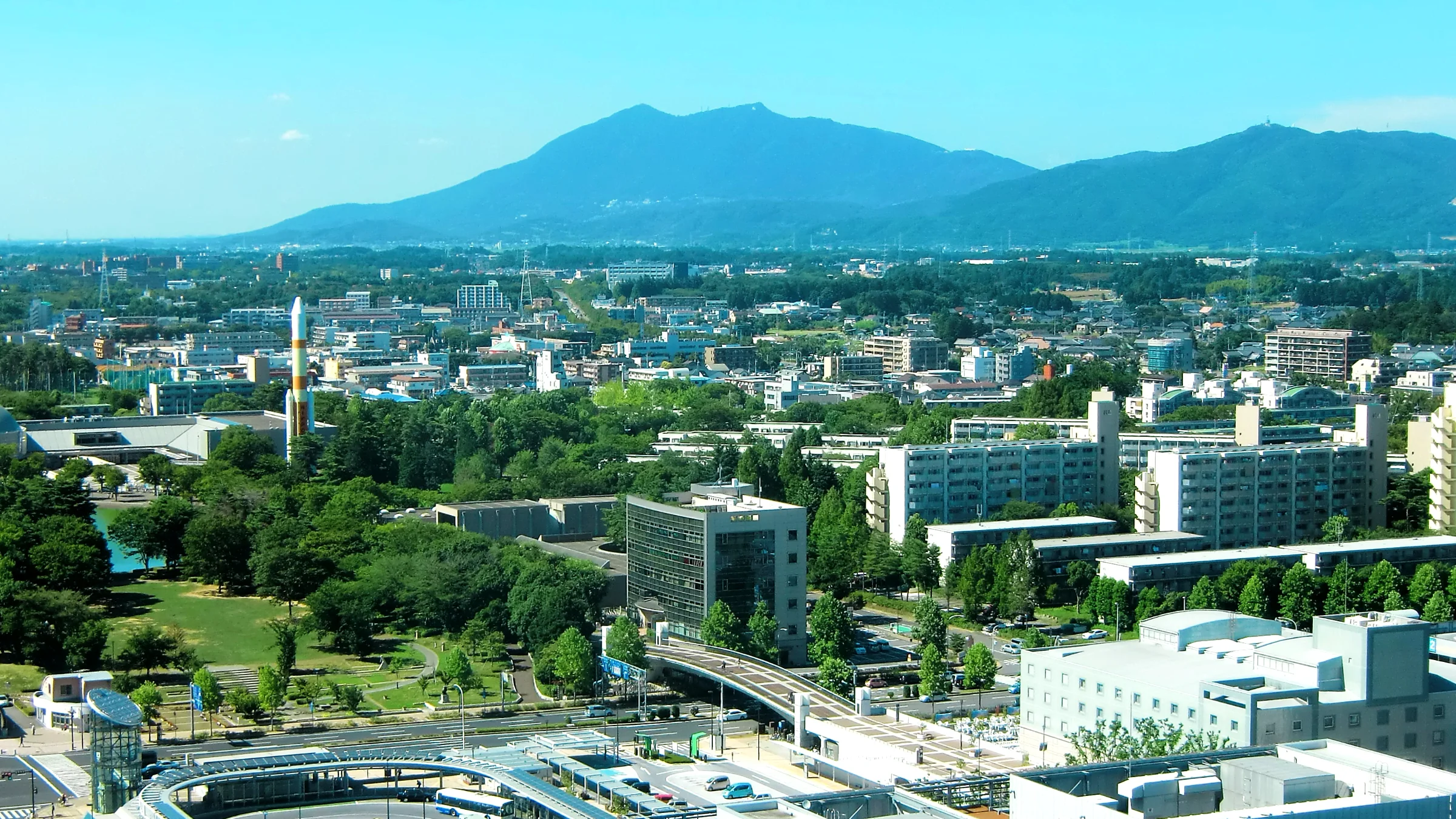
Tsukuba’s tourism problem is one of legibility rather than of attractions. The city has a strong scientific and natural draw, but its information infrastructure — signage, timetables, facility notices, congestion warnings on the Mount Tsukuba access roads — was built for domestic visitors. A foreign visitor arriving at Tsukuba Centre had limited ways to find out whether the mountain road was congested, which bus to take, or what a given notice said, and no route to flag the problem to anyone who could resolve it.
BigClouT — big data meeting Cloud and IoT to empower citizen involvement in smart cities — was the EU–Japan project that addressed this. It was jointly funded by the European Commission under Horizon 2020 (grant agreement 723139) and by Japan’s National Institute of Information and Communications Technology (NICT), with each side supporting its own partners. The project ran from 1 July 2016 to 30 June 2019, followed the earlier EU–Japan ClouT project, and operated in four pilot cities: Grenoble, Bristol, Fujisawa and Tsukuba. Each city tested the shared platform on a different urban challenge.
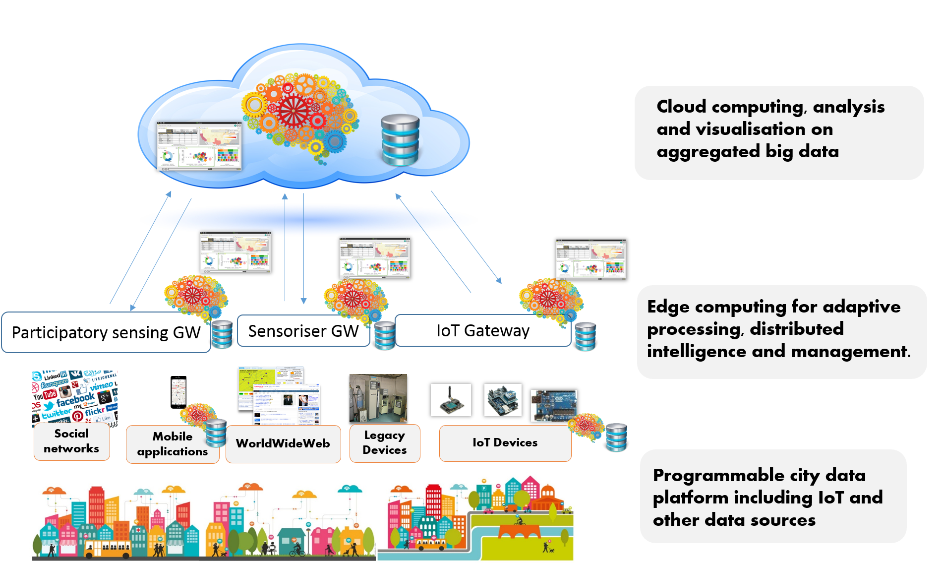
The BigClouT platform architecture: city data sources feeding participatory sensing, sensoriser and IoT gateways at the edge, with analysis and visualisation on aggregated data in the cloud. Source: BigClouT project.
Tsukuba’s role focused on tourism and visitor information. Instead of treating visitors only as consumers of information, the pilot treated them as sensors. The problems they reported, with photographs and locations attached, created a dataset showing where the city’s tourism infrastructure did not meet the needs of non-Japanese speakers. The volunteer response meant visitors got useful answers quickly, which is what made reporting worth their while.
The first trial ran from 1 to 30 November 2017 in the Tsukuba Station area and around Mount Tsukuba, in English, with user information anonymised and the collected data used only for the research. Later phases extended the approach with sensor-collected environmental and congestion data, and with information distribution through digital signage at the Tsukuba Centre hub.
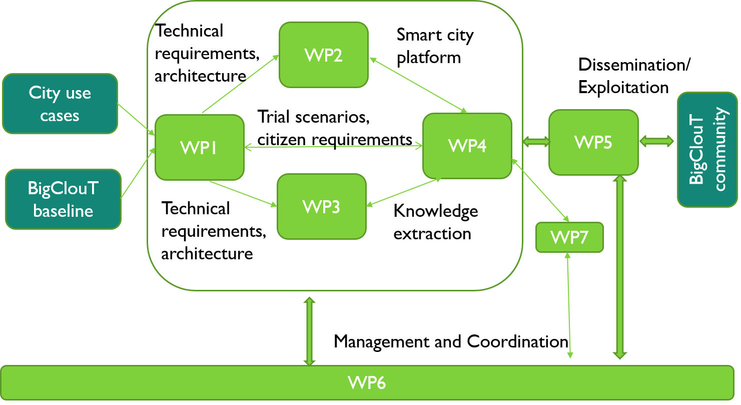
How the project was organised, from city use cases and the BigClouT baseline through to dissemination and exploitation. Source: BigClouT project.
Two visitor-facing services were built and field-tested in a live city over a month-long public trial, from 1 to 30 November 2017, across two distinct visitor zones: the Tsukuba Station area and Mount Tsukuba.
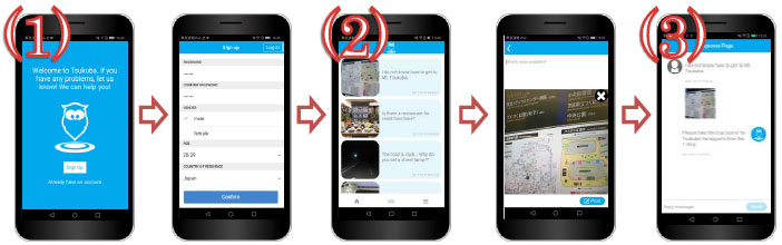
HukuRepo in use: signing up, browsing problems other visitors have reported, and receiving a reply from a local volunteer. Source: University of Tsukuba / NTT East.
The project showed a working participatory model for inbound tourism. Foreign visitors contributed geolocated problem reports, local volunteers responded, and the city received the resulting information. The method is normally used for residents reporting city issues; here it was adapted for short-term visitors who have no ongoing relationship with the city.
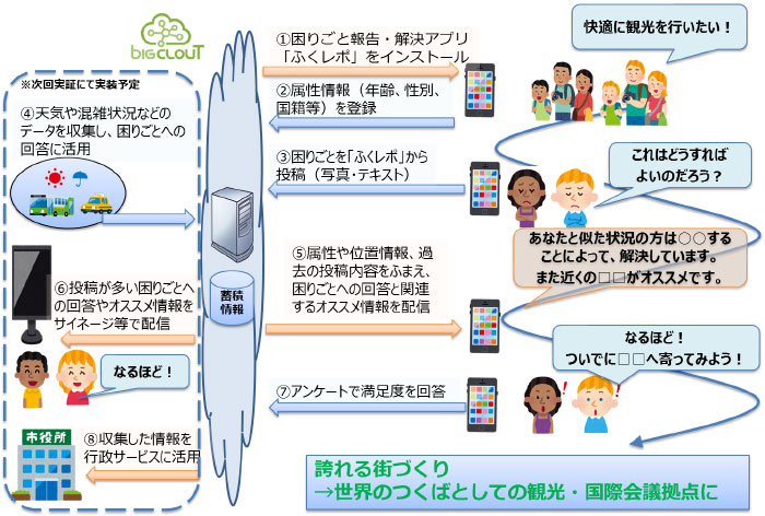
The reporting loop: a visitor posts a problem with a photograph, receives an answer drawing on similar past cases, and the collected reports feed digital signage and city services. Source: NTT East.
The applications ran on a shared, interoperable platform that also supported use cases in Grenoble (event impact monitoring, industrial estate optimisation), Bristol (mobility pattern and power consumption prediction) and Fujisawa (participatory incident reporting, sensor-equipped refuse vehicles). The tourism use case was part of a reusable system rather than a one-off build.
BigClouT produced 11 conference papers and 3 peer-reviewed journal articles covering participatory sensing systems, image anonymisation, edge computing and spatiotemporal urban computing, alongside around 10 smart-city use-case scenarios with associated business models.
The pilot led to further progress after the project ended. Tsukuba was named a Super City type National Strategic Special Zone on 12 April 2022, and the city now shares real-time Mount Tsukuba congestion information through live cameras and social media — addressing the same congestion problem the pilot identified, by different means.
BigClouT concluded on 30 June 2019. The HukuRepo application does not appear to be publicly available today, but related smart-city capabilities continue to be developed in Tsukuba, including live-camera congestion information for Mount Tsukuba and initiatives under the city’s broader Super City programme. The project contributed to the development and transfer of smart-city approaches and use-case patterns that could inform later initiatives in Japan and Europe.