
Which streets get hottest in summer? Where would more trees make the biggest difference? How can cities monitor their environment without spending a fortune?
Naples-based Latitudo 40 is working to make this possible.
On 1 October 2026, the UTA member announced a €2.9 million funding round. Vertis SGR led the round through its Vertis Venture 6 Digital Sud fund. Kurrant Ventures and CRIF also invested.
The funding will help Latitudo 40 take its technology a step further. The company wants to move beyond classic dashboards. Its next goal is to build AI agents that can query and interpret satellite data independently. This will allow city planners to ask questions in plain language and get answers backed by Earth observation data.
€2.9M
Raised to develop Agentic EO and Physical AI
Turning satellite images into better city decisions
Latitudo 40 was founded in Naples in 2017. Its mission is simple: make satellite data useful for the people who plan and manage our cities.
The company uses AI to turn satellite imagery and Earth observation (EO) data into practical climate and environmental insights. Cities and enterprises can use the data to make better decisions.
Latitudo 40 offers two products. EarthDataInsights is its analytics platform. EarthDataPlace is its marketplace for satellite data.
The technology supports work across climate resilience, urban planning, agritech and insurtech. Its partners and clients include the European Space Agency, the European Commission, Statistics Canada, Deloitte and Abu Dhabi’s Projects and Infrastructure Centre.
And the results are already visible.
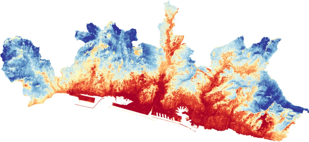
In the Urban EVOLUTION project, Latitudo 40 worked with cities across Italy. The team mapped air pollution and city heat in Naples, Catania and Perugia. It also identified nature-based solutions that could lower temperatures by around 3°C in parts of Naples. Through the EU BeatTheHeat project, it also built the Naples Thermal-Twin, which refreshes the city’s heat map at least weekly and is designed to be replicated in other cities.
In Benidorm, the company joined forces with Dinapsis. Together, they combined satellite data and AI, cutting monitoring costs by up to 85% compared with traditional high-resolution systems.
In Palermo and Altamura, Latitudo 40’s 10-metre land surface temperature algorithm now powers Planetek Italia’s Rheticus Urban Heat Island service. It helps local administrations pinpoint where tree planting, green corridors and shading would cool the city most.
In Turin, the company piloted Urban Green Navigator, an app that plans walking and cycling routes based on heat, air quality and greenery. More than 1,500 participants made over 2,000 km of trips during the pilot.
These projects show what satellite data can do when cities put it to work.
Bringing satellite knowledge to real urban projects
Latitudo 40 has also worked with fellow UTA members to turn satellite knowledge into practical planning tools.
Two projects stand out.
Sandyford Business District, Dublin
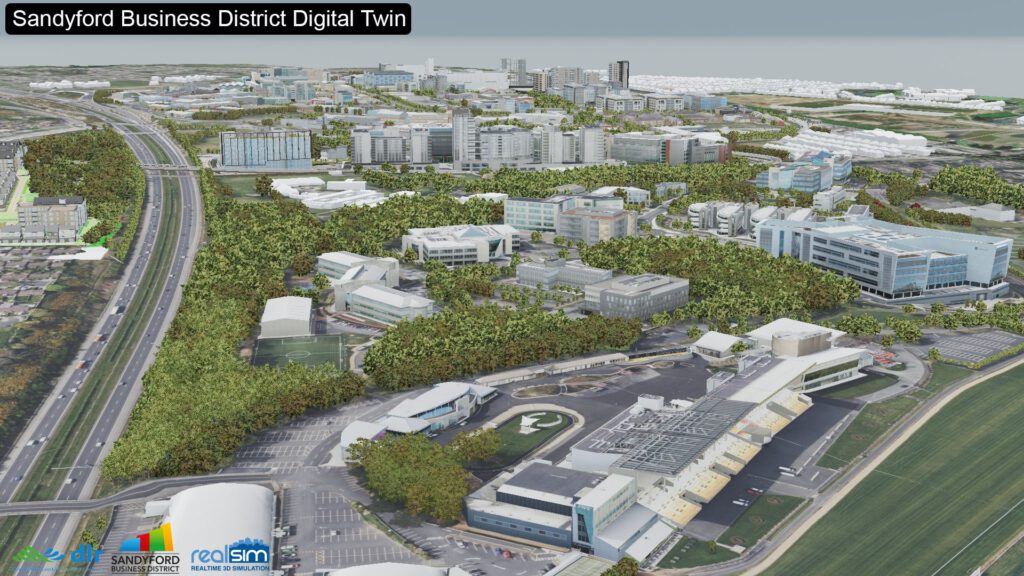
Under the Interreg IB-Green project, Latitudo 40 mapped city heat and tree cover using satellite data. Its findings fed into cooling simulations and a district-scale digital twin developed with fellow UTA member RealSim.
The work helped shape the design of the new Sandyford Civic Park.
Grenoble-Alpes Métropole, France
In the CLIMAGRE pilot, Latitudo 40 supplied satellite indicators for a city heat digital twin. The team developed the tool with other UTA members, Kentyou and RealSim.
Planners can now test different scenarios before construction begins. They can consider options such as planting more trees or changing building designs. This helps them understand the likely impact before committing to a solution.

What comes next? AI that understands our cities
The new funding will support platform development, research and development, and international sales.
One priority stands out: a proprietary AI foundation model that Latitudo 40 plans to integrate into all its products.
The company’s roadmap focuses on two areas.
Agentic EO
AI agents will query, combine and interpret satellite, geospatial and environmental data independently. Instead of operating complex dashboards, users will be able to ask questions and get meaningful answers.
Physical AI
The next step is to connect this intelligence to the systems that manage cities, infrastructure and other real-world assets.
The company has already taken its first steps. At ESA’s Acceleration Days, Latitudo 40 demonstrated a prototype conversational agent.
The idea is simple. A city planner could ask which streets were hottest last summer. The agent would query the relevant geospatial data, interpret the results and provide an answer in plain language.
No need to dig through dashboards or interpret layers of satellite imagery. Just ask.
Latitudo 40 has since turned this prototype into TALA, its Earth Intelligence Co-pilot. TALA puts the company’s Agentic EO strategy into practice: users explore satellite data through the questions they need to answer, with no specialist remote-sensing knowledge required. In EarthDataInsights, a few prompts are enough to run an urban heat analysis. Explore TALA at tala.latitudo40.com.
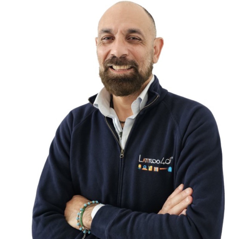
“With Agentic EO, we are building agents capable of autonomously combining and interpreting satellite and geospatial data. Satellite data gives us a unique view of how cities change: how they heat up, how air quality shifts and how urban areas grow. The challenge is making this information accessible and useful for those who make decisions. We are now developing AI-powered tools that will allow city planners to ask questions in plain language and get clear, data-driven answers. Through the UTA network, we hope to work with cities, researchers and technology partners to test these tools against real urban challenges and develop solutions together.”
Gaetano Volpe, CEO, Latitudo 40
From Naples to cities around the world
Today, Latitudo 40 combines knowledge in space technology, telecommunications, and artificial intelligence to help cities use Earth observation data.
The company has already used its technology in Italy, Ireland, France, and Spain. By working with UTA members, it has looked at how satellite data can help cities understand their challenges and plan better.
With €2.9 million in new funding and its TALA agent, Latitudo 40 is now ready to grow its work.
The company wants to make satellite intelligence easier for city planners and decision-makers to use. It aims to turn complex data into useful insights that help build better cities.
Want to discover what satellite data could reveal about your city?
Contact us at contact@urbantechnologyalliance.org. We will connect you with Latitudo 40.