The data analytics platform is based on satellite images and artificial intelligence, providing economically sound and sustainable decision-making. A flexible, zero-code approach allows for the creation, deployment, and scaling of geospatial applications.
Latitudo 40 has integrated catalogues from major satellite operators and promising start-ups in Earth observation. Their acquisition engine automatically finds and cuts out the required image portions for specific analyses. Continuous monitoring activities involve automatic tasking on multiple satellites without human intervention, connecting to partners’ planning systems. The company collects petabytes of images from various sensors and constellations, ensuring the highest level and quality of services for customers.
Lattitudo40 provides:
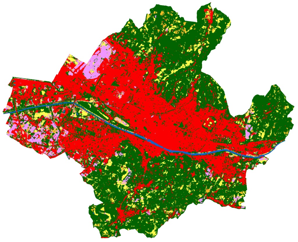
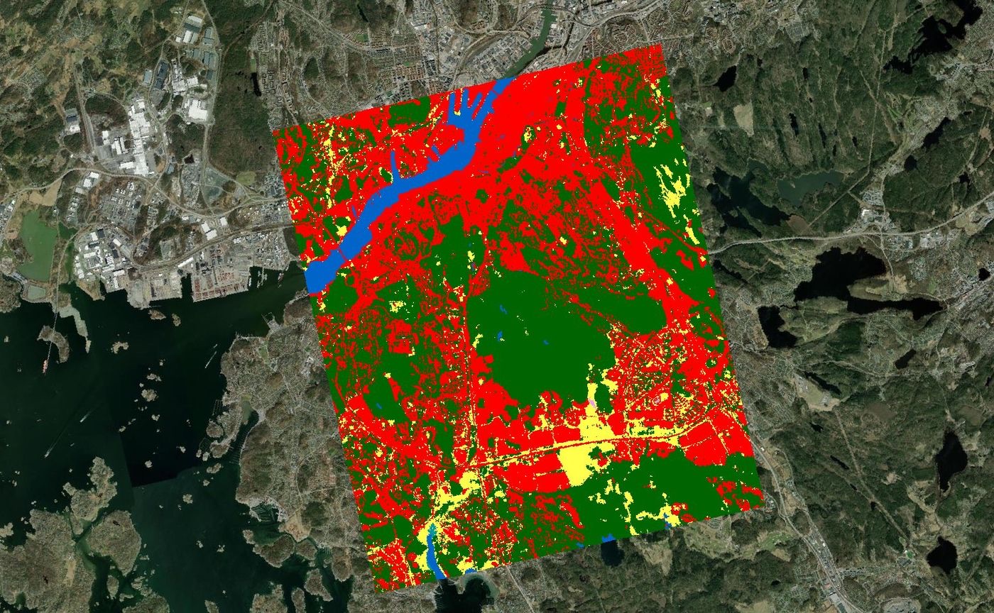
The Land Cover layer provides a comprehensive overview of the Earth’s surface, classifying it into 11 classes. These categories include urban areas, forests, water bodies, croplands, and more.
The layer has been meticulously crafted utilizing exclusively Sentinel-2 satellite imagery, among other topographic layers. Advanced Deep Learning algorithms were applied to obtain this dataset, ensuring a precise representation of the global landscape.
Use Cases:
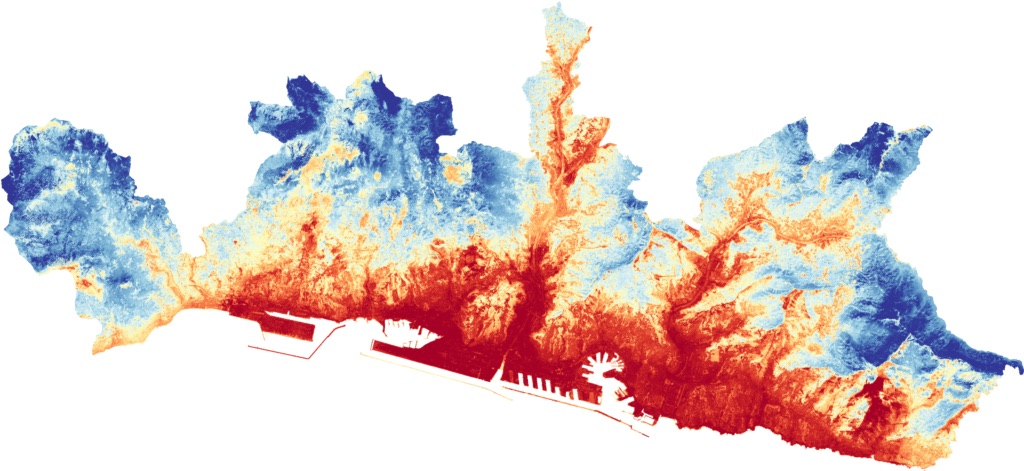
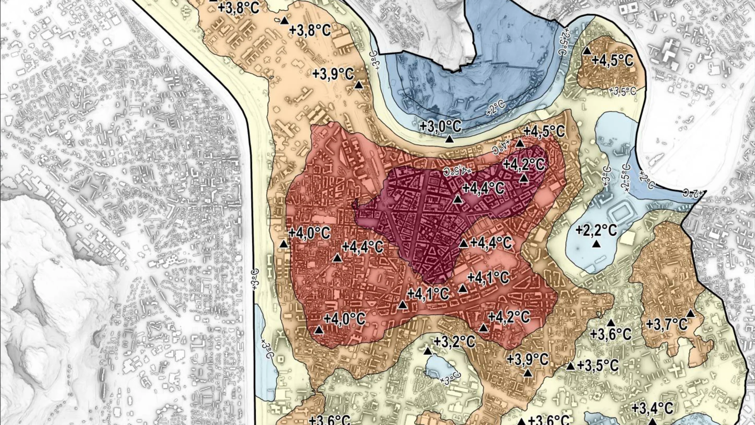
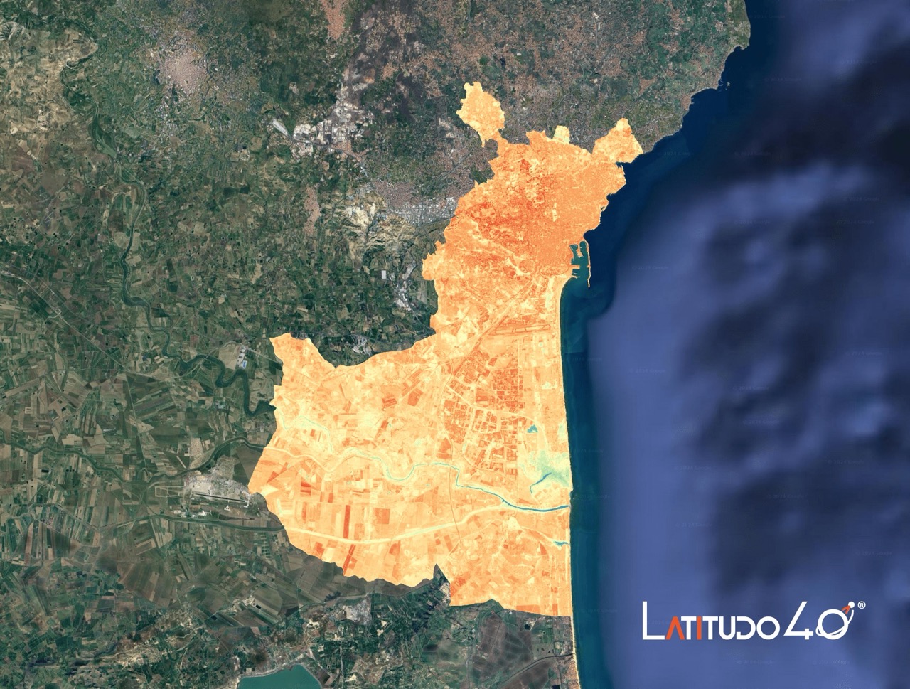
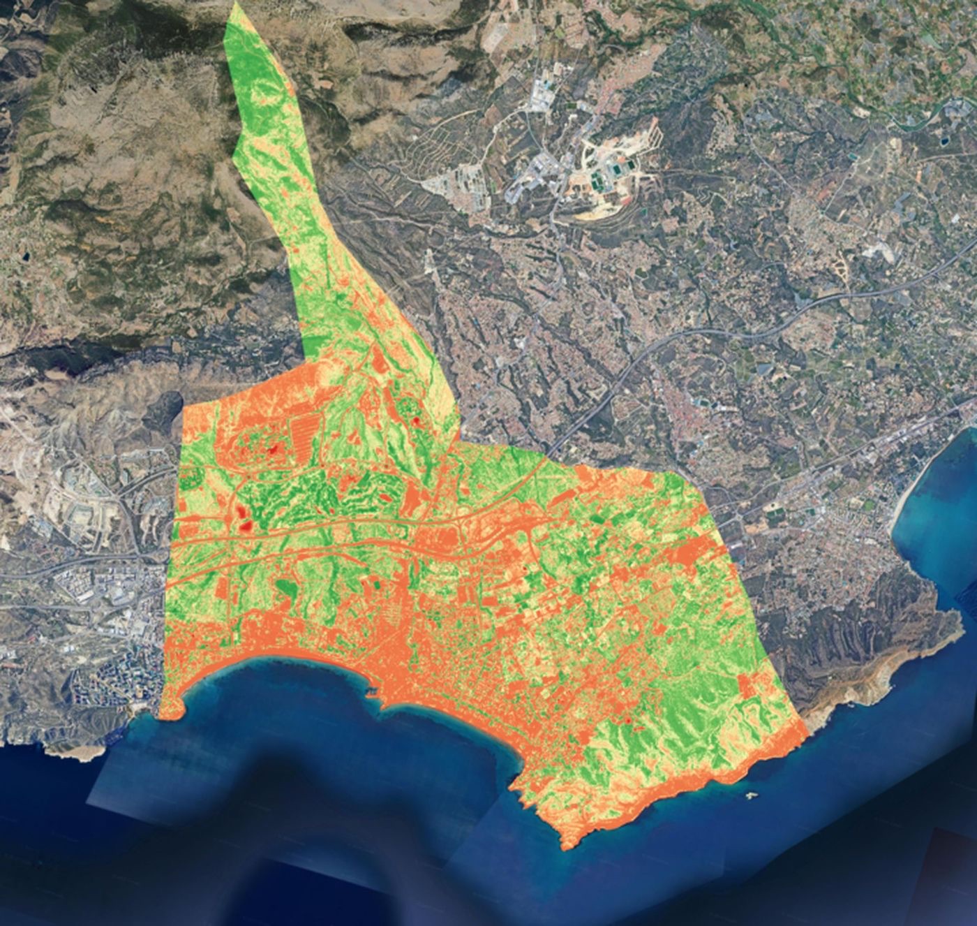
The Surface Urban Heat Island layer assesses the UHI effect, highlighting areas that become warmer than surrounding rural areas due to human activities like transportation and urbanization.
By analyzing ground temperature data, an index from 0 to 100 is generated, where higher values indicate greater UHI exposure, pinpointing critical zones.
Use cases:
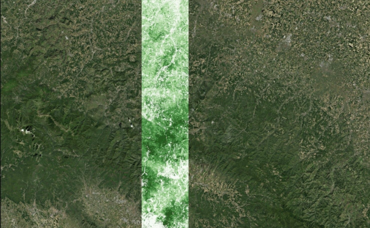
The Tree Cover Density (TCD) layer depicts the percentage of tree canopy cover across a range of 0-100%. It can be used to identify regions exhibiting varying levels of tree canopy cover and thus aid in evaluating deforestation or reforestation patterns in rural areas. The product has a spatial resolution of 10 meters, and it’s generated via Machine Learning and Sentinel-2 MSI.
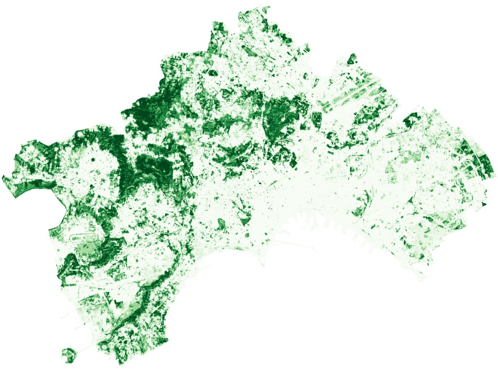
Use Cases:
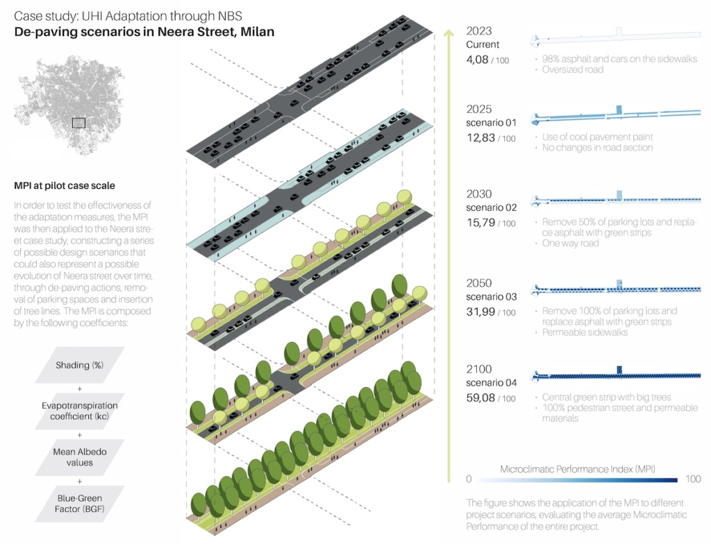
Latitudo 40 Place Simulator is a tool capable of simulating and evaluating future urban scenarios using exclusively satellite images. It allows you to objectively compare design and strategic alternatives in order to evaluate the best one. It therefore allows you to test urban solutions in a virtual way, thus avoiding very expensive and time-consuming modifications and field tests, measuring the environmental benefits and the impact on the area under consideration. Latitudo 40 Place Simulator significantly supports urban planning and the sustainable management of cities and territories.
Urban EVOLUTION is a research initiative addressing air pollution and the urban heat island effect through AI, remote sensing, and Nature-Based Solutions (NBS).
Piloted in Naples, Catania, and Perugia, the project assesses CO₂ emissions, particulate matter (PM), and temperature dynamics to evaluate the real impact of urban green infrastructure. Latitudo 40 provides advanced geospatial analytics to map pollution patterns and measure the performance of NBS in diverse Mediterranean contexts.
The initiative aims to develop scalable, replicable models for sustainable urban transformation, contributing to the Paris Agreement objectives by supporting carbon reduction, air quality improvement, and climate-resilient city planning.
Doing Good partnered with Latitudo 40 to assess land surface temperature (LST), land cover, and urban vegetation performance in Gothenburg (Sweden) and Chott el-Djerid (Tunisia).
Using multispectral and thermal satellite data enhanced by AI algorithms, Latitudo 40 identified urban heat islands, analysed heat-retaining surfaces, and evaluated the cooling efficiency of green spaces.
The solution enabled data-driven urban planning, targeted cooling interventions, and continuous nationwide monitoring on a weekly basis. Monitoring costs were reduced by 85% compared to commercial high-resolution imagery, while maintaining high analytical accuracy.
This case demonstrates how scalable satellite monitoring supports climate-resilient urban development mitigates heat stress across diverse geographies.
Dinapsis partnered with Latitudo 40 to assess and enhance the microclimatic performance of green infrastructure in Benidorm, L’Alfàs del Pi, and Santa Pola, Spain.
Through the EarthDataPlace platform, Sentinel-2 data and AI-driven processing enabled NDVI monitoring, Park Cool Island (PCI) analysis, and microclimatic performance classification of urban vegetation. High-resolution vegetation health data, updated every 15 days, enabled continuous assessment of cooling effects and green infrastructure efficiency.
The solution supports targeted urban interventions, improves climate resilience, and provides cost-effective monitoring – delivering up to 85% savings compared to traditional high-resolution systems while maintaining strong analytical performance.
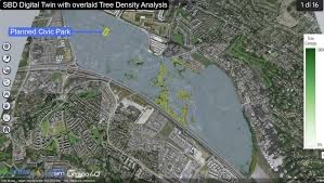
Latitudo 40 and RealSim, both members of the Urban Technology Alliance (UTA), collaborated within the EU-funded IB-Green project to mitigate heat stress in the Sandyford Business District, Ireland.
By combining Earth observation data with Digital Twin technology, the partners conducted Surface Urban Heat Island (SUHI), Land Surface Temperature (LST), and Tree Density analyses to evaluate Nature-Based Solutions and simulate alternative redevelopment scenarios.
The initiative supports the transformation of a 0.8-hectare site into the new Sandyford Civic Park, enabling data-driven, climate-resilient planning and demonstrating how UTA members jointly deliver scalable solutions for sustainable urban regeneration across Europe.
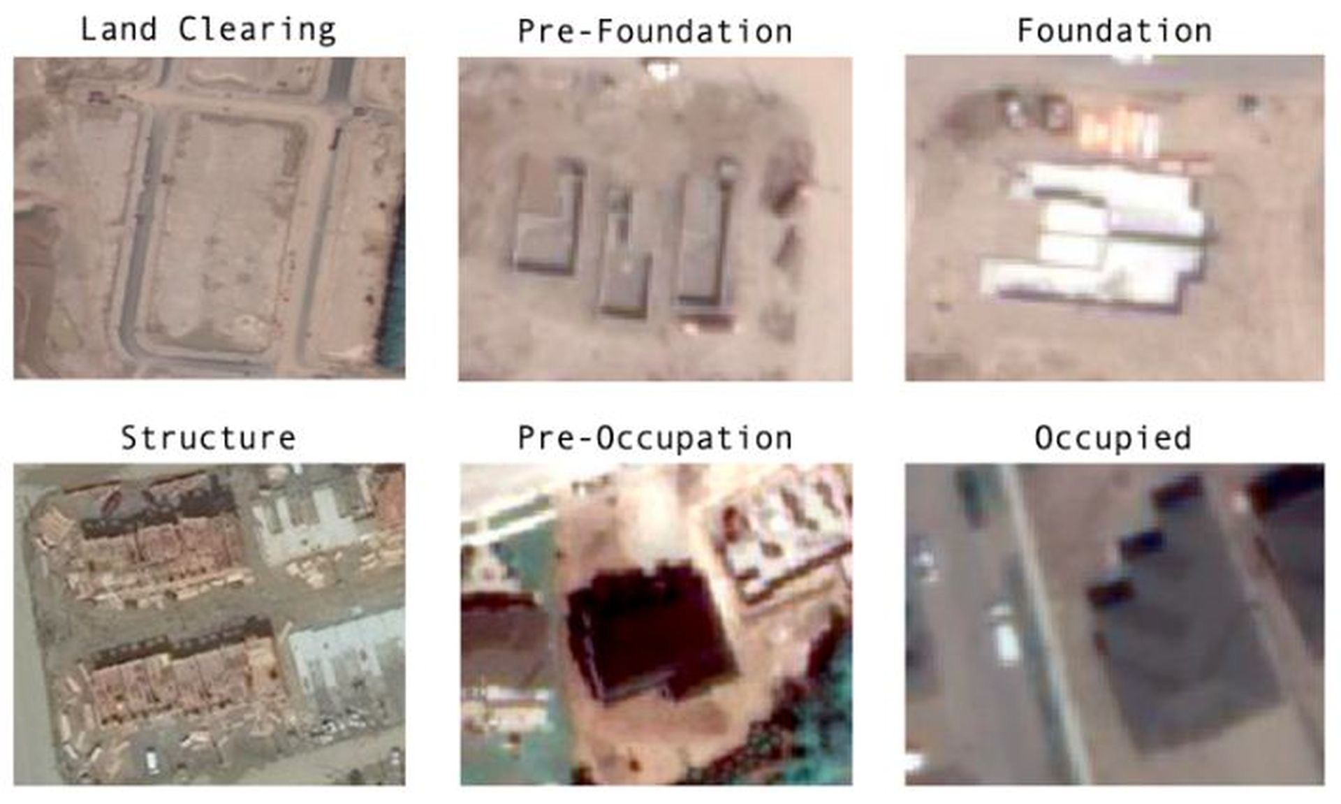
Statistics Canada partnered with Latitudo 40 to develop a scalable solution for tracking construction activities nationwide and identifying key development phases – from land clearing to structure building.
Using Sentinel-2 satellite imagery and machine learning, the system first detects active construction (93.25% accuracy) and then classifies phases such as land clearing, foundation work, and structure building (81.77% accuracy).
The solution provides real-time insights to support urban planning, economic policy, and sustainable infrastructure development, enabling data-driven decisions aligned with national growth and environmental objectives.
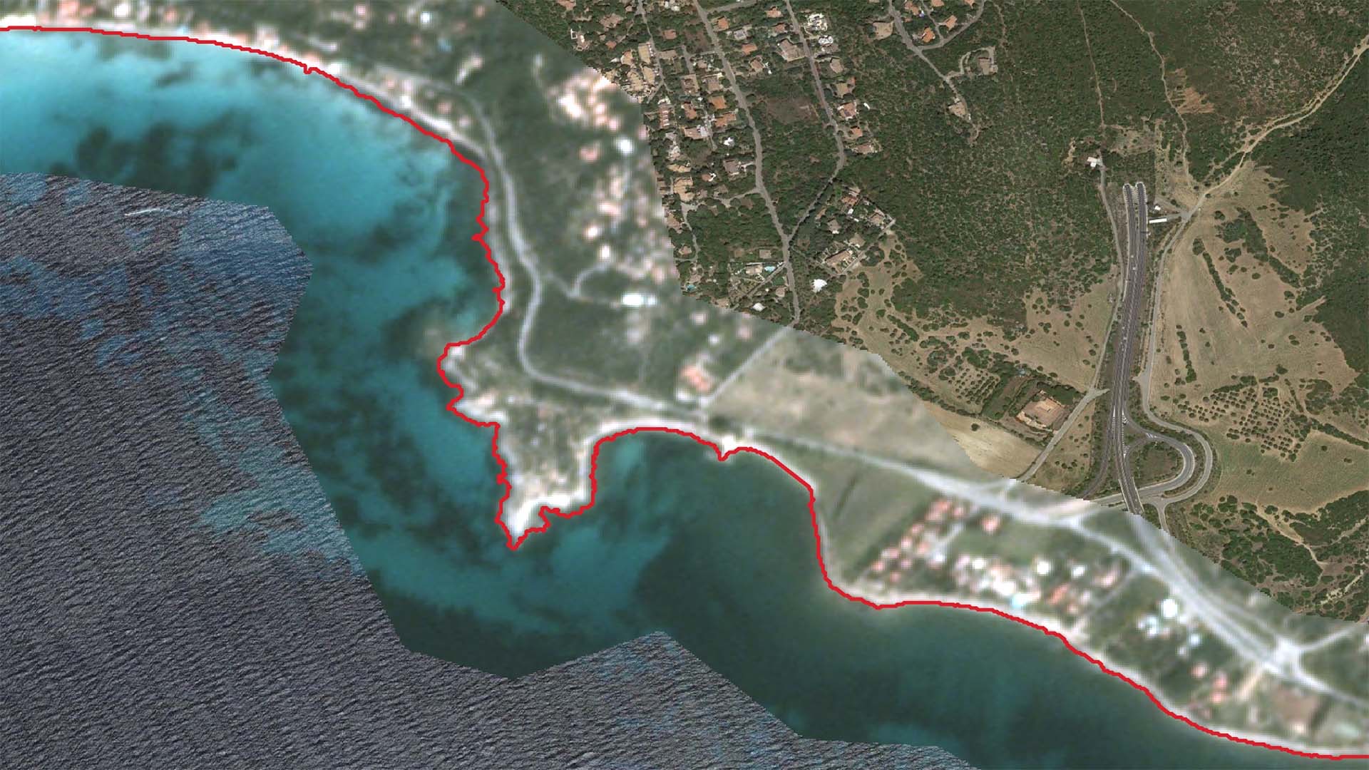
Latitudo 40 delivers advanced coastline monitoring services using high-resolution satellite imagery and automated processing workflows to support coastal resilience and environmental protection.
For the municipalities of Capoterra and Rome, historical and seasonal shoreline changes were mapped using Airbus Pleiades, SPOT, and PlanetScope imagery (≤3 m resolution, 0% cloud cover priority). The analysis produced structured coastline shapefiles for winter and summer periods, enabling precise monitoring of erosion trends and shoreline dynamics.
By integrating satellite imagery with tidal reference data, the solution provides accurate, repeatable, and scalable monitoring to support coastal planning, climate adaptation strategies, and marine ecosystem protection.
GeoGreen was developed to support Movyon (Autostrade per l’Italia Group) in identifying and classifying land areas surrounding highways to optimise sustainable interventions.
The solution enables two integrated scenarios: assessment of land suitability for photovoltaic installations and monitoring of green areas with quantified CO₂ absorption. Using geospatial analysis and satellite data, approximately 300 managed areas were evaluated to calculate carbon sequestration levels and support sustainability reporting and carbon credit valorisation.
Through interactive dashboards and structured datasets, GeoGreen facilitates evidence-based decision-making, balancing renewable energy deployment with reforestation strategies in line with corporate climate objectives.