EnviroSim Web Lite Public 3D Viewer

🛠️ Tool

Context and problem statement

Planning consultations have traditionally relied on plans, elevations and a handful of CGI stills, shown at events that residents must attend in person. That format is hard to interpret and excludes anyone who cannot come at the set time. When COVID-19 closed the door on in-person sessions, Fingal County Council needed a way for residents to explore proposals remotely.

Solution overview

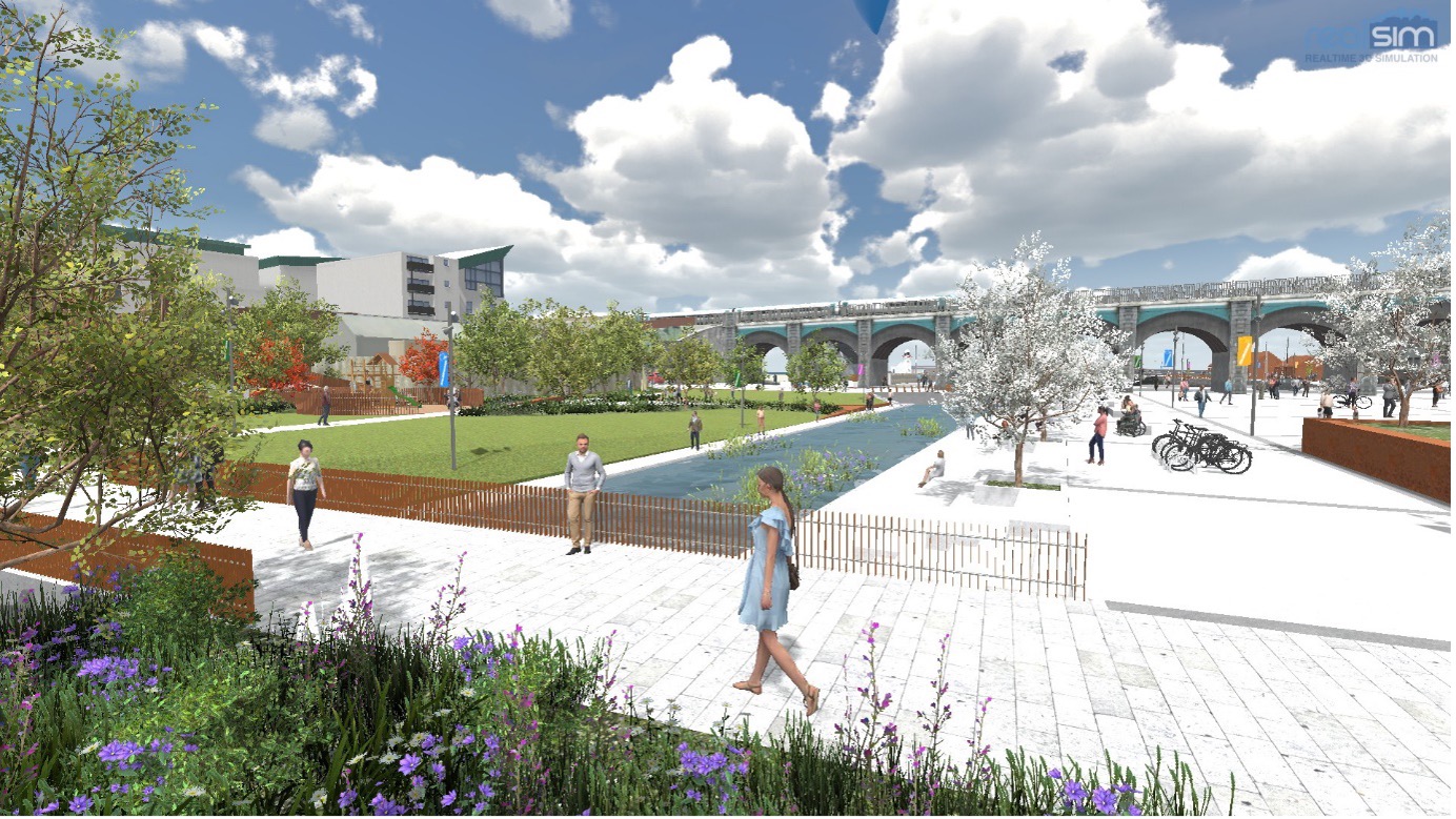
RealSim published its geospatially accurate digital twins of Balbriggan and Swords through a lightweight web viewer. Residents navigate the proposed schemes the way they would use Street View, seeing each intervention inside the existing streets rather than in isolation, and can switch between times of day, seasons and weather conditions, or view populated scenarios such as a street festival on a rejuvenated Quay Street.

Three public viewers are live, all listed on the Council’s Fingal digital twins hub: Balbriggan Quay Street and Harbour, Balbriggan 2–4 Dublin Street Creative Hub and Swords Cultural Quarter. The public viewer now runs as EnviroSim Web Lite, alongside EnviroSim Web Pro, a login-controlled version with full analysis tools for internal council use.
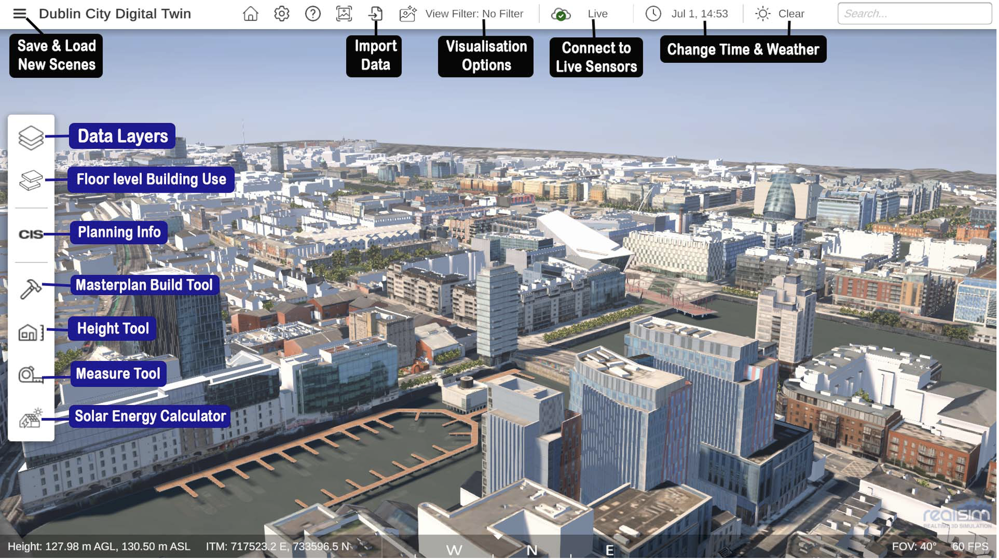
EnviroSim Web Pro on the Dublin City Digital Twin, with data layers, planning information, masterplan, height, measurement and solar tools, live sensor feeds and time and weather controls. Image: RealSim.
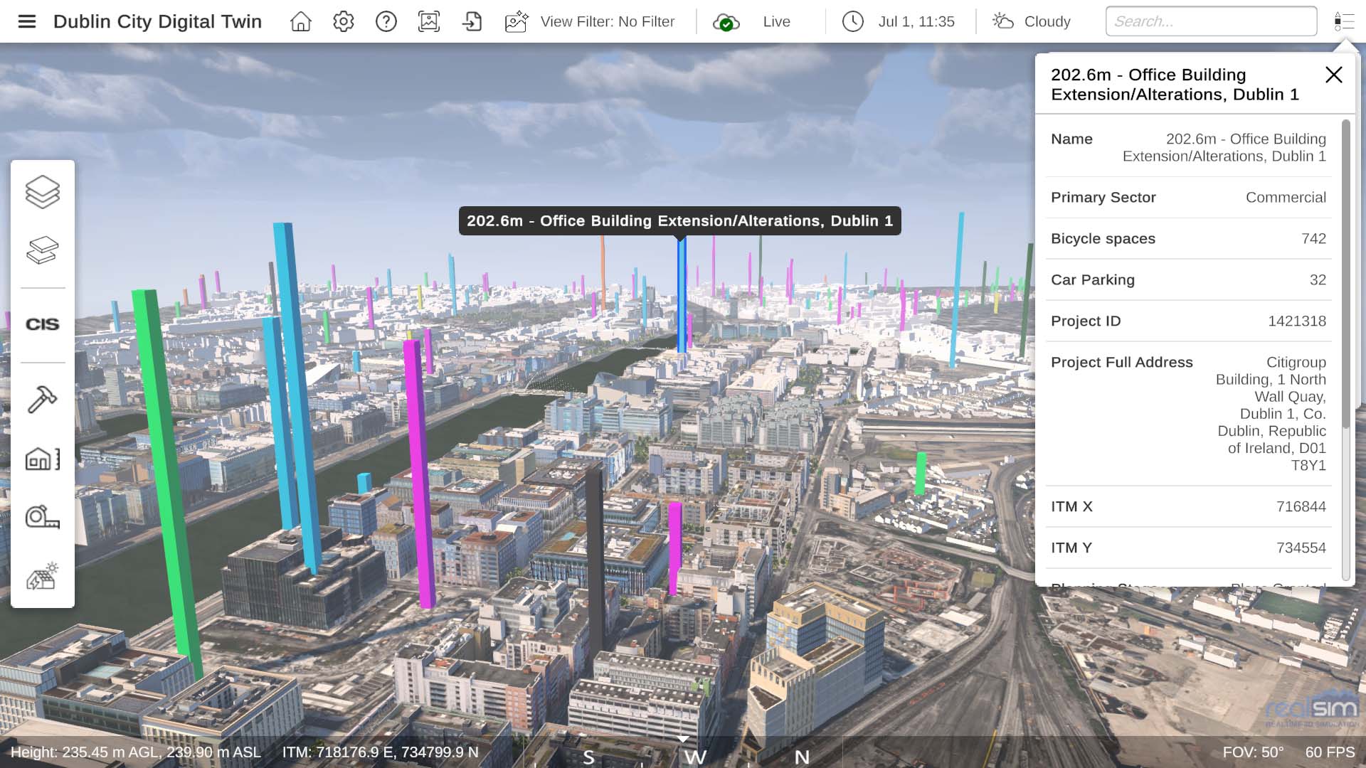
Planning applications across Dublin Docklands shown as coloured columns, with project details on selection. Image: RealSim.
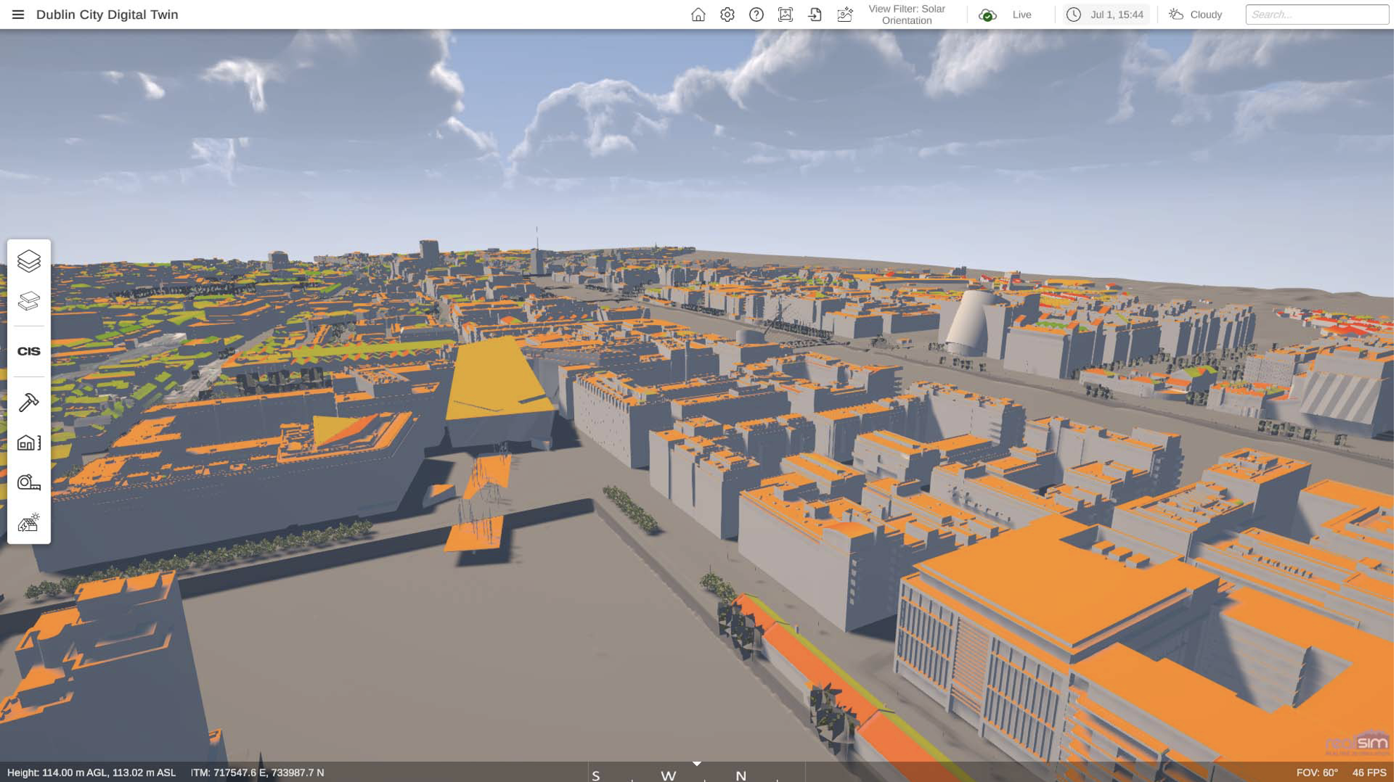
Solar potential of the Docklands roofscape, calculated in the digital twin. Image: RealSim.

Functional Scope and Features

– Browser-based 3D navigation from any device, with no software to install
– Proposed schemes shown in their real urban context
– Time-of-day, seasonal and weather variation
– Populated scenario views of how spaces will be used
– Always-on public access alongside in-person consultation
– Companion Web Pro edition with planning data, solar and carbon tools for council staff

Use Cases and Deployments

Fingal County Council, Ireland — Balbriggan Quay Street and Harbour (since April 2020). Ireland’s first publicly accessible 3D web viewer of a proposed public realm scheme. The viewer went through three iterations across two rounds of public consultation and drew more than 100 submissions. The scheme received planning approval in November 2024 and was completed in September 2026.

Swords Cultural Quarter and new civic building (since May 2022). A public web viewer of the proposed Cultural Quarter supported consultation before planning approval in August 2024. The building is due to open in early 2027.

Balbriggan 2–4 Dublin Street Creative Hub. A third public viewer, listed with the other two on the Council’s Fingal digital twins hub.

All three are part of the 3D Web and Virtual Reality Planning Consultation in Fingal pilot, which won three eGovernment Awards, including Overall Best Project.

Related Challenges

Interested in this solution?

Get in touch to explore deployment opportunities or propose a complementary approach.

Share the Post: