
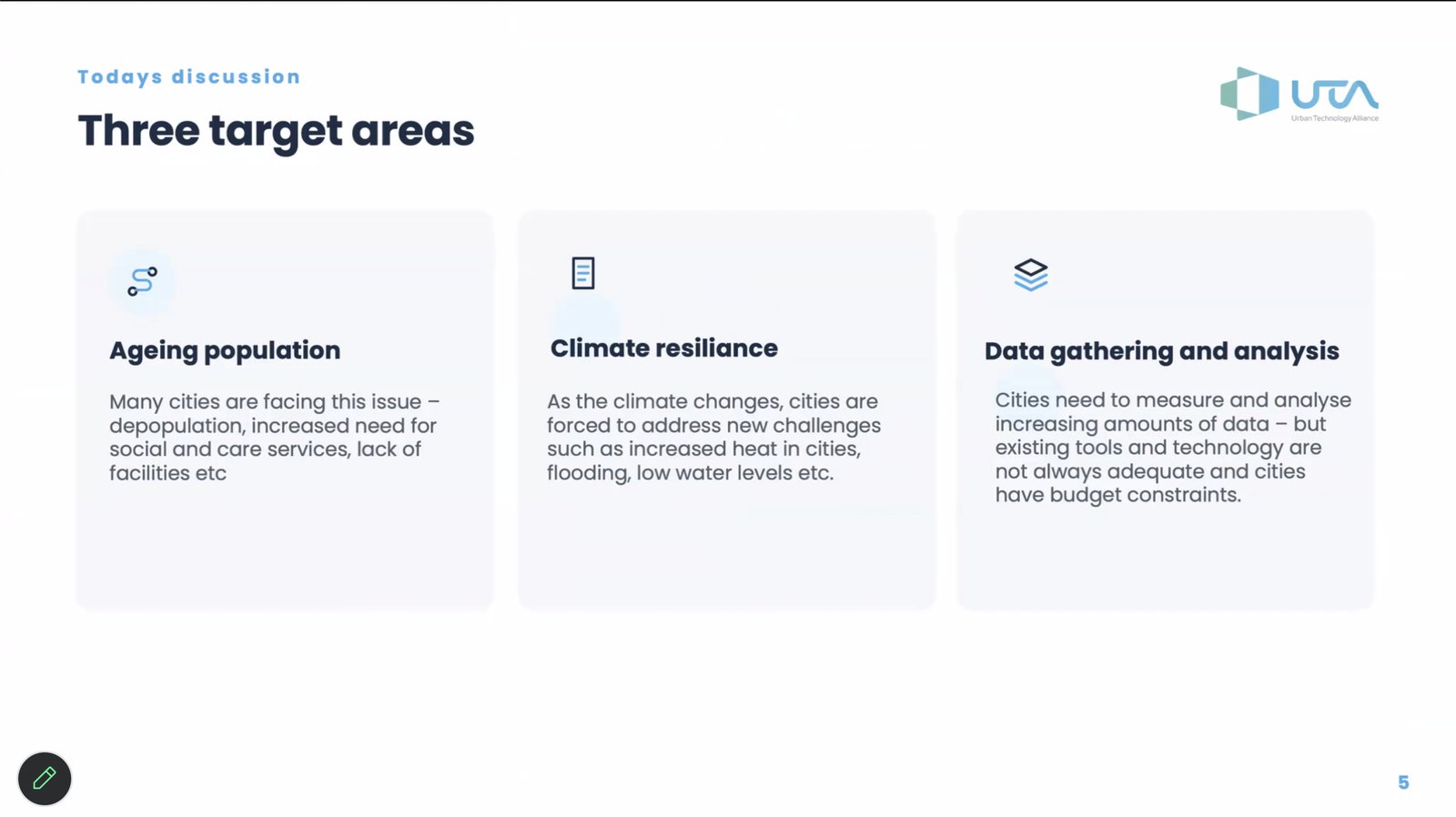
On 8 October 2026, the Urban Technology Alliance (UTA) held the final session of its UTA Café EU–Japan Webinar Series. UTA Café is designed for UTA members to share their expertise and projects with a wider audience, and this series was dedicated to collaboration between the EU and Japan. The first session introduced UTA’s partners and shared their experiences. The second session explained how Japanese organisations, now eligible for Horizon Europe, can join and lead European research and innovation projects. The last session shifted the focus from funding to the shared challenges that European and Japanese cities face and highlighted the people already working to solve them.
Prof. Takuro Yonezawa from Nagoya University, who led the EU–Japan Webinar Series, opened the session. He explained that climate change, digital transformation, and AI have made urban challenges too complicated for any one city or country to handle alone. Cities need to share their experiences to find effective solutions.
When a City Outgrows Its Design Limits
Prof. Jin Nakazawa started his talk by highlighting two major changes in Japan: climate change and an ageing, shrinking population. Much of Japan’s infrastructure was built in the late 20th century, when there were many workers and the climate was more stable. Today, that situation has changed.
Tokyo’s climate data shows significant changes. Since 1980, average temperatures have risen by about 2°C. The city now experiences more than 13 days each year with temperatures over 35°C, which was once uncommon. The number of tropical nights, when temperatures stay above 25°C, has grown from about 20 to 33 a year. Days with hourly rainfall over 100 mm have also doubled. These changes can cause maintenance holes to overflow, flood streets and underpasses, and sometimes even result in loss of life.
Japan’s population is changing dramatically. When Professor Jin Nakazawa was growing up, around one in four people in Japan was under 15. Today, that figure has fallen to roughly one in ten (Japan Statistics Bureau, 2026).
The consequences extend across society. By 2050, Japan is projected to have only about 1.3 working-age people for every person aged 65 or over, down from about two in 2025 (Japan Cabinet Office, Annual Report on the Ageing Society 2026).
The challenges are already visible. In 2023, 19,039 people with dementia were reported missing (Nippon.com, based on National Police Agency data). Care services are also under pressure: in 2024, Japan recorded a record number of elder-care business closures and bankruptcies, including 529 home-visit care providers (Tokyo Shoko Research). Meanwhile, in Tokyo, waiting times for cremation can exceed eight days in winter, reflecting growing pressure on end-of-life infrastructure (Nippon.com).
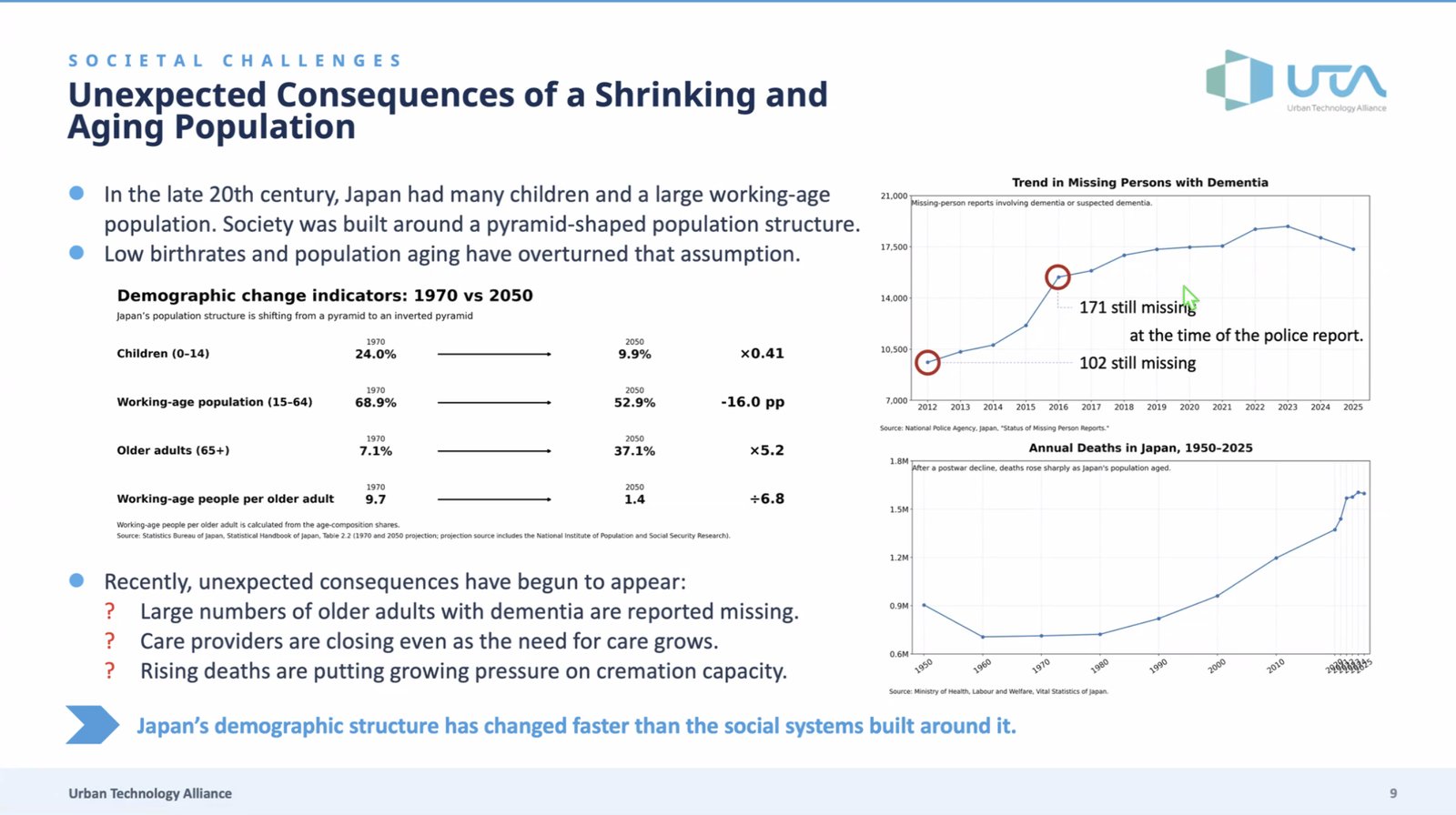
Demographic change is now reshaping Japan’s population, its care systems, public services and urban infrastructure.
Prof. Jin Nakazawa said that Japan’s physical and social systems have outgrown their original design limits. Places once considered safe are no longer safe, and services built for the old population structure can’t rely on people alone anymore. Cities now need machines to monitor conditions and catch problems that people might miss.
This raises three technical questions.
First, what should we monitor? New risks often stay hidden, whether under a maintenance hole cover or in data and images.
Second, when should we monitor? Timing is important. If stormwater will overflow a maintenance hole in 30 seconds, authorities need to warn people quickly. They must balance the speed of simple AI models with the accuracy of more complex ones.
Third, at what scale should we monitor? Flooding and missing-person cases can affect an entire city, but no city has ever used tens of thousands of sensors before.
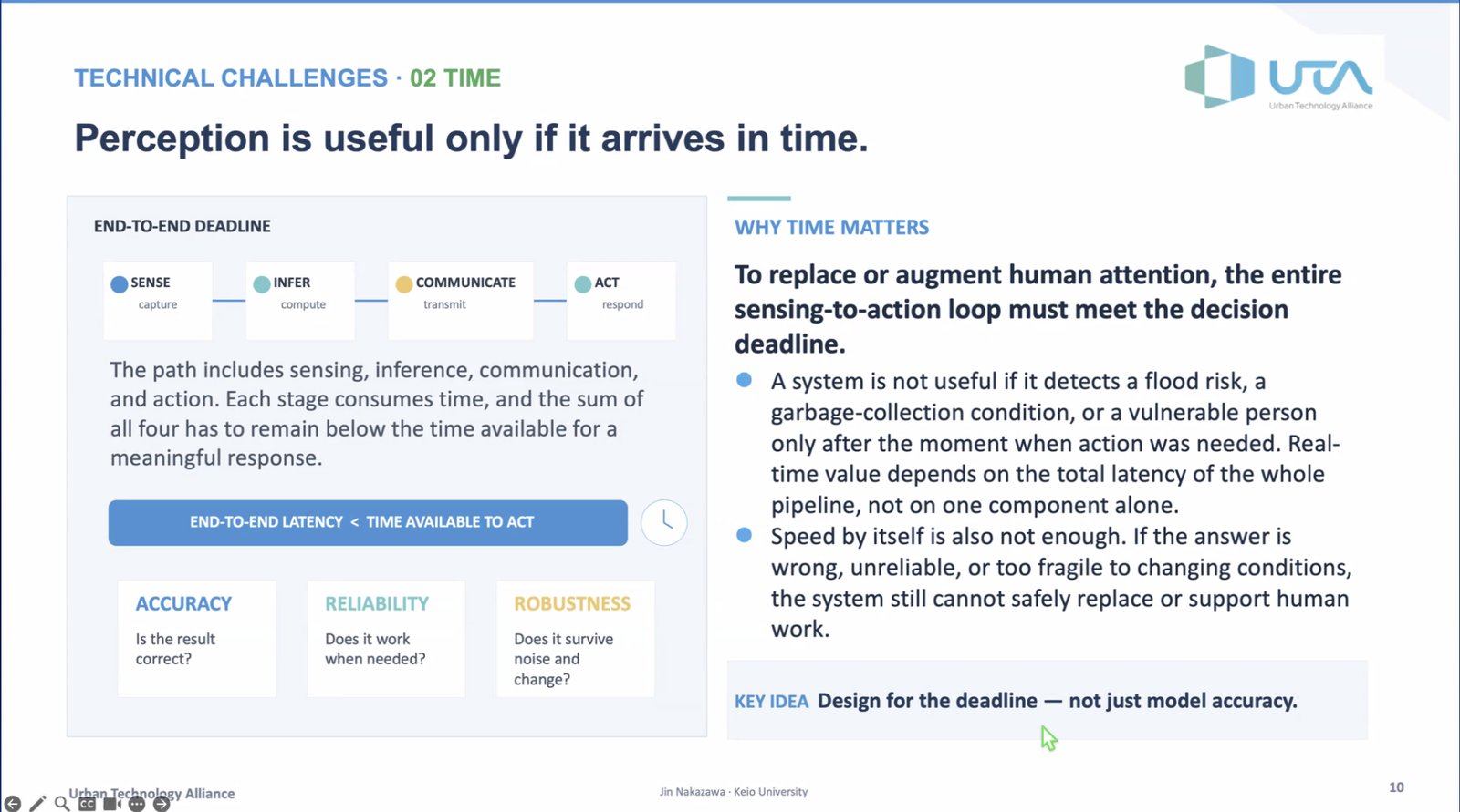
Prof. Jin Nakazawa suggests adding sensors, AI, and connectivity to existing urban infrastructure. His lab is working with local governments to test this idea.
For example, after flooding near Keio University’s Shonan Fujisawa Campus, the team worked with Fujisawa City and the police to install water-level sensors in three maintenance holes. Because iron covers block radio signals, they built a multi-hop LPWA (ZETA) sensor network that sends readings in 600 milliseconds. During a typhoon on 21 September, rainfall peaked at 9 mm in ten minutes, and water levels reached 185 cm in a three-metre-deep maintenance hole. The last 1.2 metres of space gave residents and officials the information they needed to decide when to evacuate.
The team’s second example uses garbage trucks as a city-wide sensing platform. These trucks travel on almost every street nearly every day. By adding GPS, sensors, and cameras, about 40 AI-equipped trucks in Fujisawa and Kamakura now track where and how much rubbish they collect, spot potholes in real time, and gather detailed environmental data. They could even help find missing older people. In effect, the fleet works as a mobile sensor network covering the whole city.
Showing People the View from Their Own Front Door
Gavin Duffy, CEO of RealSim, shifted the discussion from sensing to communication. He explained that planning in Ireland involves a lot of paperwork. One proposal might include 198 technical documents online, making it hard to find the most important one, the design document. Public consultations are often short and don’t reach everyone in the community. Many objections come from confusion rather than real technical concerns, and these can delay projects for years.
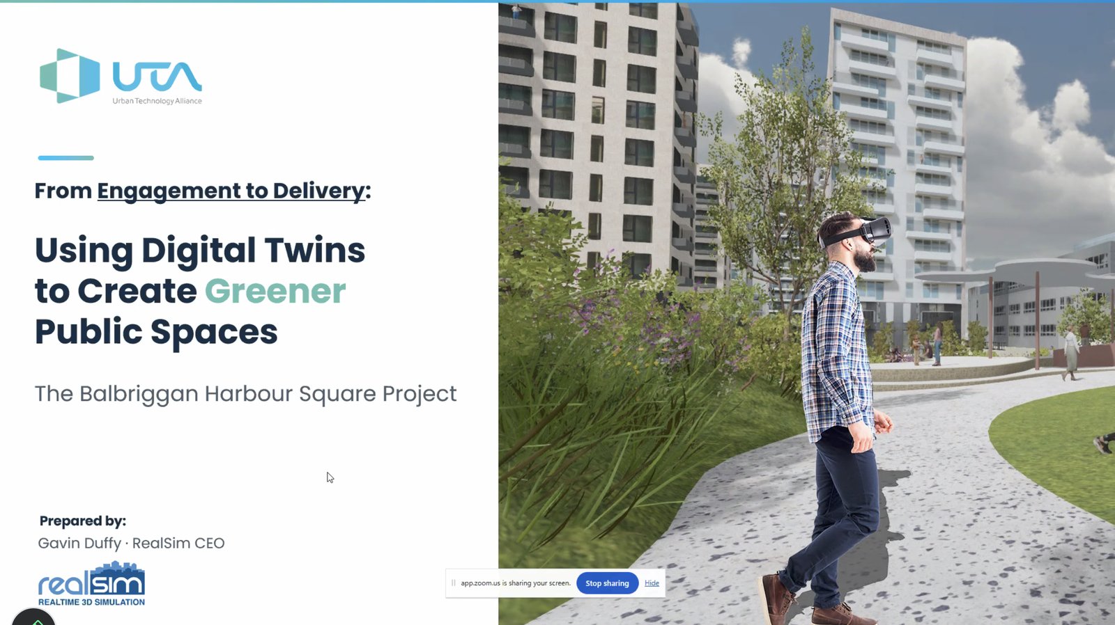
Gavin Duffy shared a case study from Balbriggan, a town of 26,000 people just north of Dublin. It is Ireland’s youngest and most diverse town, with an average age of 33, and one in three residents born outside Ireland. Fingal County Council wanted to turn a car park next to the beach and harbour into green space, with tiered areas for events and other amenities. But people in Ireland like to park close to their destination; the proposal needed some convincing.
RealSim made a digital twin of the town. They define a digital twin as a realistic, accurate visual copy built from three parts: geometry captured by aerial, drone, and street-level mapping; a rendering platform that works on desktop computers, the web, and virtual reality (VR); and extra data layers. Accuracy is important because residents need to recognise the view from their own front door.
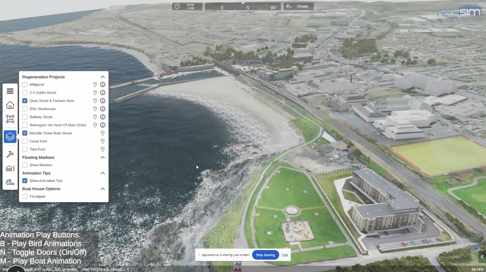
During COVID-19, the council launched an online WebGL viewer that let anyone turn the proposed development on and off. It was the first time an Irish local authority published a fully interactive 3D view of a proposed development.
When restrictions eased, the council brought a VR experience to public events, first using HTC Vive headsets and later Oculus Quest.
In 2023, the council shared the final design and placed VR headsets in five local libraries. Each library chose “VR champions” to help visitors explore the proposal.
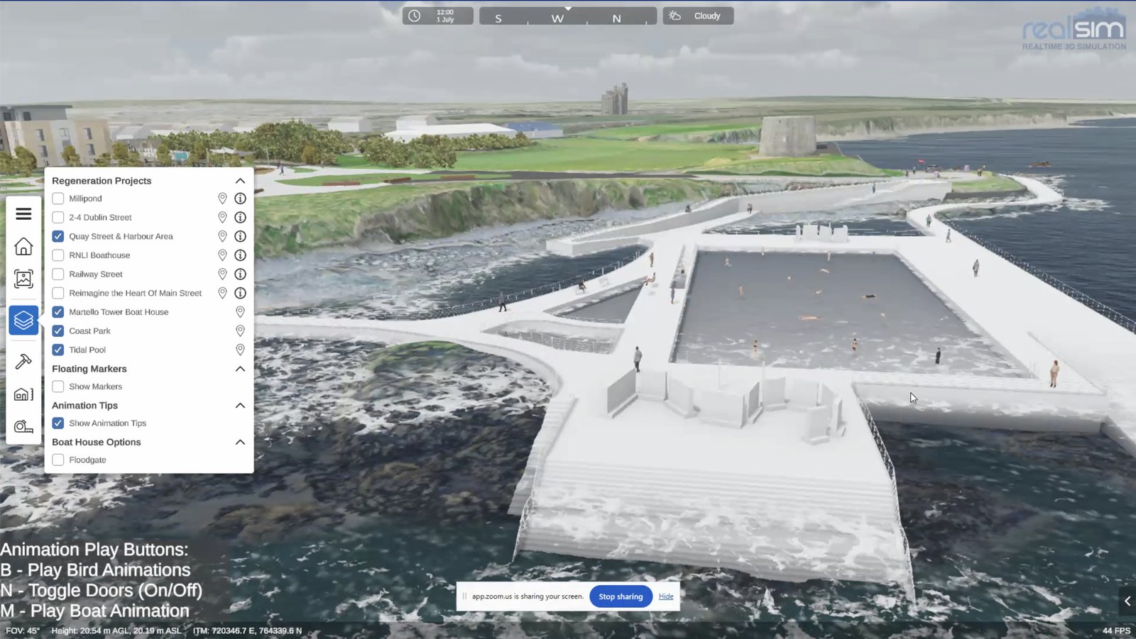
In 2024, the project received planning approval with strong public support, and construction began in 2025. The new public space is now finished. This approach has won awards, and the digital model has become a lasting asset instead of a one-time visualisation. The council now uses it to support other projects, such as restoring a historic boathouse, creating a new park, a possible tidal pool, and developments in other towns. Architects can also add their models directly to the viewer.
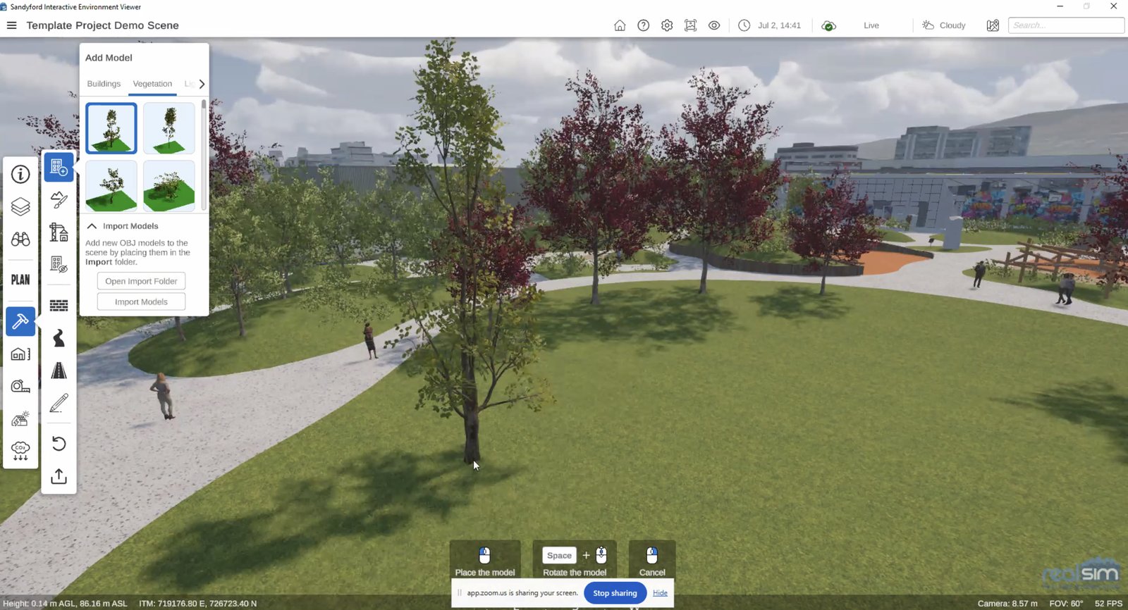
Gavin Duffy also showed RealSim’s work in Sandyford Business District, done as part of the Interreg IB-Green project with UTA member Latitudo 40. The partners created a playful, Minecraft-style tool that lets users place trees and see how much carbon each one could capture. Users can export the results as GeoJSON for further analysis.
Gavin Duffy concluded that most decision-makers don’t have technical expertise. The harder part is presenting data in ways people can understand and use.
Discussion: Shared Challenges, Different Perspectives
Rodger Lea, UTA’s Technical Director, moderated the discussion. He opened with a brief introduction to UTA’s role as a non-profit network connecting cities, industry and academia, with members in 20 countries across three continents.

UTA has delivered more than 50 urban pilots, covering areas such as flood planning with Paris-Saclay, urban freight in London and Manchester, and smart park management in Fujisawa. Rodger Lea emphasised that cities often trust other cities most, making experience exchange central to UTA’s work. He then invited the panellists to explore three key themes.
Ageing, Isolation and Technology
Rodger Lea: What challenges related to ageing and demographic change are the cities you work with trying to address, and what solutions have you seen?
Prof. Takuro Yonezawa spoke about loneliness and social isolation, particularly among men who retire at 65. Although online services help people live independently, they can also reduce opportunities for human interaction.
He cited a Harvard Business Review analysis of how people use generative AI, which ranked therapy and companionship as the leading use cases. He warned that AI designed to please users in the moment can deepen isolation rather than alleviate it, a concern the Harvard Gazette article “Got emotional wellness app? It may be doing more harm than good” also explores.
Rodger Lea: Gavin, one of the towns you work with has the opposite demographic profile, with a very young population. Are Irish cities experiencing similar demographic changes?
Gavin Duffy described Japan as “the canary in the coal mine” for Europe, meaning that Japan’s demographic challenges offer an early warning of what other countries may face in the coming decades. Although Ireland still has a relatively young population, births peaked in 2009 and have since followed a downward trend. This suggests that Ireland, too, will need to prepare for the long-term effects of demographic change, including an ageing population and potential labour shortages.
He stressed that labour shortages stem from more than demographic change. Fewer young people are choosing careers in construction, care, and teaching, creating challenges across essential sectors. Digital tools could help close these gaps, from serious games that draw on the skills of the “Fortnite generation” to better ways to reach newcomers who may have limited access to local information channels.
Rodger Lea: Older residents are often less familiar with these technologies. What have you learned about engaging them? Does it all come down to having people on the ground?
Gavin Duffy agreed that personal contact remains essential. When engineers planned a 600-metre greenway through a small rural village, they took an interactive model from door to door and discussed it with residents at their kitchen tables.
By contrast, a costly road scheme in Galway triggered public anger because planners considered local knowledge, including how buses turn, too late in the process. Gavin Duffy explained that identifying and correcting mistakes in a virtual model cost far less than digging up a completed road.
Rodger Lea: Jin, what have you observed in Japan regarding ageing and demographic change?
Prof. Jin Nakazawa said mobility is another critical issue. Cities need machine vision because fewer people will be available to monitor their surroundings, but they must also help older residents move around independently.
In Japan’s hilly towns, many older people struggle to reach a supermarket on their own. Because physical mobility and loneliness are closely linked, mobility-enhancing technologies can also help reduce social isolation.
Adapting to a Climate That No Longer Follows the Rules
Rodger Lea: Jin, from Fujisawa’s perspective, what are the main climate challenges facing cities? Is better prediction the primary solution?
Prof. Jin Nakazawa explained that municipal officers cannot address climate change as a whole. Instead, they must manage numerous local problems, such as the low-lying area in front of his campus that floods during heavy rain. Staff cannot monitor every vulnerable location themselves.
He stressed that prediction alone is not enough. Cities also need practical, on-the-ground support. Knowing that a hazard is approaching does little good if residents still cannot evacuate safely.
Rodger Lea: Gavin, you have worked on carbon capture in planning and urban heat islands. What challenges are cities facing, and how are they responding?
Gavin Duffy described how Ireland has shifted its focus from prevention towards adaptation. During a summer drought, some farmers had to feed their cattle the fodder they had saved for winter.
Engineers now design flood barriers and designate areas that can flood deliberately to protect surrounding communities. Events once described as “one in a hundred years” now occur every five to ten years. Gavin Duffy also noted that a major storm in western Ireland in 2024 would have caused far worse flooding had it coincided with high tide.
Digital twins allow cities to test these scenarios before they happen. However, local hydrology remains complex, and cities will need AI and data analysis to understand how climate risks affect individual streets.
Rodger Lea: Takuro, have you been involved in climate resilience projects?
Prof. Takuro Yonezawa described research by his students that combines human movement data with remote sensing to examine how climate conditions affect the way people use urban spaces.
He also highlighted the growing impact of extreme summer heat. People now carry handheld fans and wear air-conditioned clothing, almost like spacesuits in a hostile environment. Cities need more effective and attractive ways to protect residents from extreme temperatures.
Rodger Lea connected these examples to UTA’s work, including the urban heat island project in Grenoble, flood planning for the River Seine with Paris-Saclay, and Barcelona’s network of cool public spaces, such as libraries, where people can seek shelter during heatwaves.
Putting Urban Data in the Hands of City Officers
Rodger Lea: City staff rarely have deep technical expertise, and UTA has found it difficult to transfer solutions and data between cities. Jin, what have you learned about collecting, managing and sharing urban data?
Prof. Jin Nakazawa, who works with Prof. Takuro Yonezawa on data management, outlined three key challenges:
- Collection: Cities need to choose the right communication protocol. Prof. Takuro Yonezawa’s earlier decision to use XMPP has proved effective.
- Storage: Data volumes grow rapidly. The garbage-truck project alone generates several terabytes of data each year. The team currently stores this data on the laboratory’s own servers but will need a more sustainable long-term solution.
- Access: City officers need straightforward ways to use data. A data abstraction layer could allow them to ask questions such as, “What happened in this part of Fujisawa last week?” without needing to understand the underlying storage systems.
Rodger Lea closed the discussion by highlighting a recurring need across UTA’s projects: cities want tools that bring different data sources together, let them manage their own data, accommodate new sources, and enable them to share information wherever possible.
What Comes Next
Across three sessions, the series has shown that Europe and Japan face many of the same urban challenges, although they often encounter them at different stages. Japan’s experience with ageing and infrastructure offers European cities an early view of what may lie ahead, while European initiatives, such as the Balbriggan project, demonstrate how technology can build public support for change.
With Horizon Europe now open to Japanese organisations, these shared challenges create opportunities for joint research, innovation and practical urban projects.
UTA will continue the conversation at Smart City Expo World Congress in Barcelona, from 3 to 5 November 2026. As one of the world’s leading smart city events, it offers UTA members a chance to present their solutions at the UTA booth, discuss shared challenges, and connect with the wider urban innovation community.
Contact us at contact@urbantechnologyalliance.org and subscribe to the UTA newsletter to stay up to date with our activities.