
The first session of the UTA Café | EU–Japan Webinar Series took place on 22 July 2026. Titled “From Urban Challenges to Collaborative Solutions in Europe and Japan,” it brought together experts from both areas to discuss how international collaboration, data, and new technologies can help cities address today’s urban challenges. The programme included UTA member organisations such as Grenoble Alpes Métropole, Kentyou, Latitudo 40, RealSim, Nagoya University, and JRISS. They demonstrated how working together on digital twin solutions can help tackle the urban heat island effect, from using Earth observation data to supporting evidence-based decisions. Researchers from Nagoya University and JRISS also shared new ways to build social connections with AI and boost urban mobility with data analytics, showing how cross-border teamwork can help cities become smarter, more resilient, and more focused on people.
A Worldwide Testing Environment for Cities
The Urban Technology Alliance (UTA) calls itself a worldwide testing environment for cities. It is a neutral, trusted platform that connects cities facing urban challenges with researchers, industry partners, and technology providers who can develop practical solutions. Founded in Geneva, UTA is a non-profit organisation that intends to bridge the gap between city needs and innovation by making sure technologies are tested and validated in real urban environments before being used more widely.
“Cities don’t need more technology looking for a problem. They need solutions that answer a real challenge. The only way to trust a solution for a city is to try it in a city. That is what our pilots are for.”
— Dr Levent Gürgen, President of the Urban Technology Alliance and CEO of Kentyou
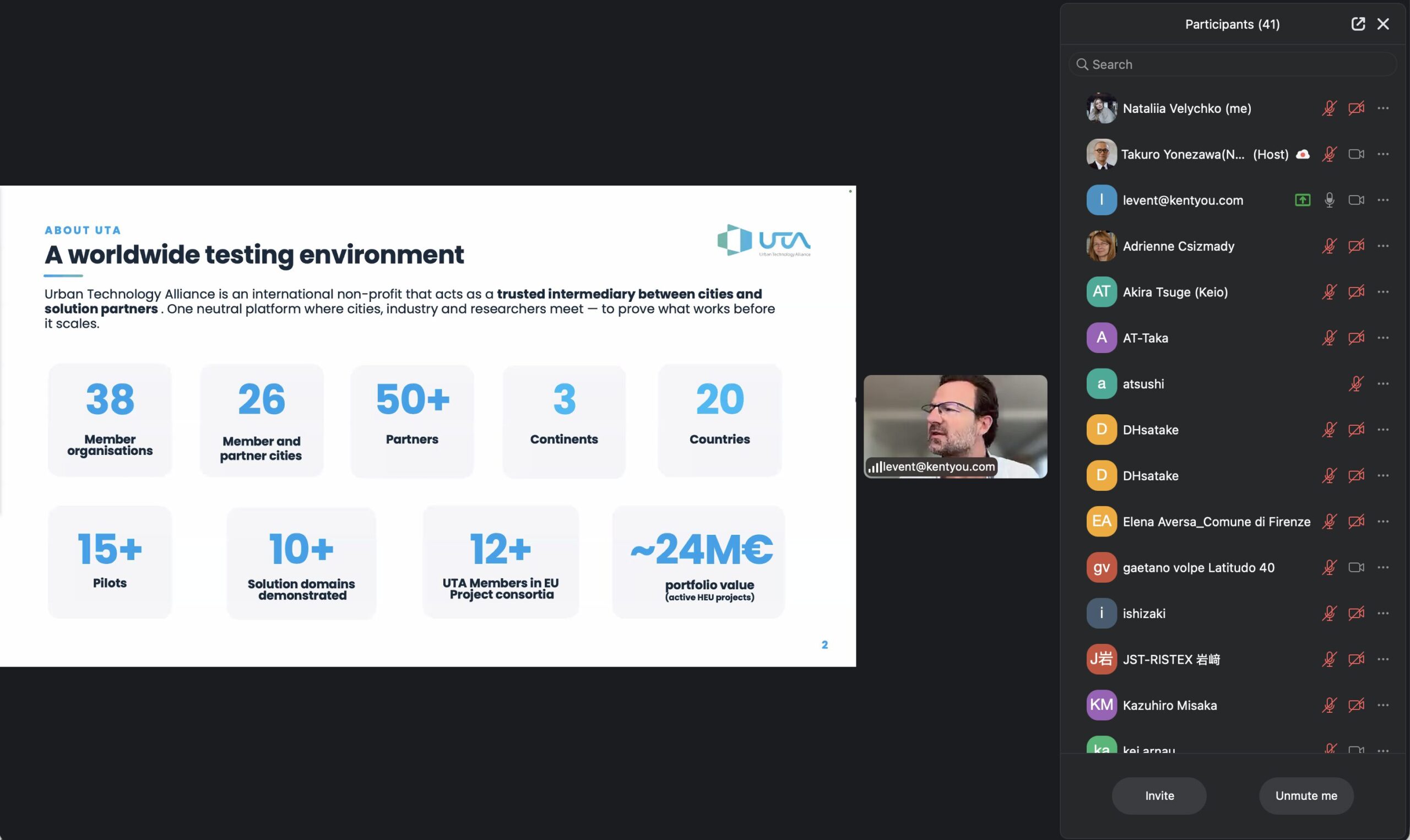
At the start of the webinar, Dr Levent Gürgen explained UTA’s mission to connect cities, universities, industry, and technology providers to turn urban challenges into real-world solutions through collaboration. Today, UTA includes 38 member organisations from 20 countries on 3 continents. It has completed more than 15 pilot projects in over 10 areas and, with its members, takes part in European research and innovation projects worth about €24 million.
Dr Rodger Lea, UTA’s Technical Director, explained how the Alliance puts collaboration into practice. He said UTA focuses on three main activities: creating city-scale testbeds to try out new solutions, connecting cities with the right research and technology partners, and sharing lessons learned from all pilot projects so others can benefit from these experiences.

“When a city raises a problem, our job is to find the funding and bring the right partners to the table — researchers for early-stage challenges, technology providers for mature solutions. Sometimes the fastest solution is simply connecting a city with another city, such as New York or Barcelona, that has already solved a similar challenge.”
— Dr Rodger Lea, Technical Director, Urban Technology Alliance
The webinar also showed the wide range of UTA’s international projects. The webinar also showed the wide range of UTA’s international projects. Recent and current pilots include efforts to reduce urban heat in Grenoble, smart traffic management in Istanbul and Helsinki, intelligent parking in Barcelona, smart parks in Fujisawa (Japan), connected intersections in New York, and sustainability work in Vancouver. UTA is also part of several Horizon Europe projects, such as MICAD and Urban Flow.
Grenoble: mapping the heat that satellites can see but planners can’t
The first live case study focused on urban overheating. Laurent Deslattes from the City of Grenoble explained that Grenoble is warming faster than the planet overall. Its mountain location makes the effect stronger, with local temperatures rising by about +2.5°C compared to a global average of around +1.5°C.
Laurent Deslattes said the main challenge was missing data. The urban heat-island effect depends on many things, like building height, shape, materials, colour, shadows, vegetation, water, and surface reflectivity (albedo), but much of this information was not available. The team’s first step was to create these missing data layers by reprocessing updated satellite images. This allowed them to simulate, compare, and optimise development projects for heat before construction started.
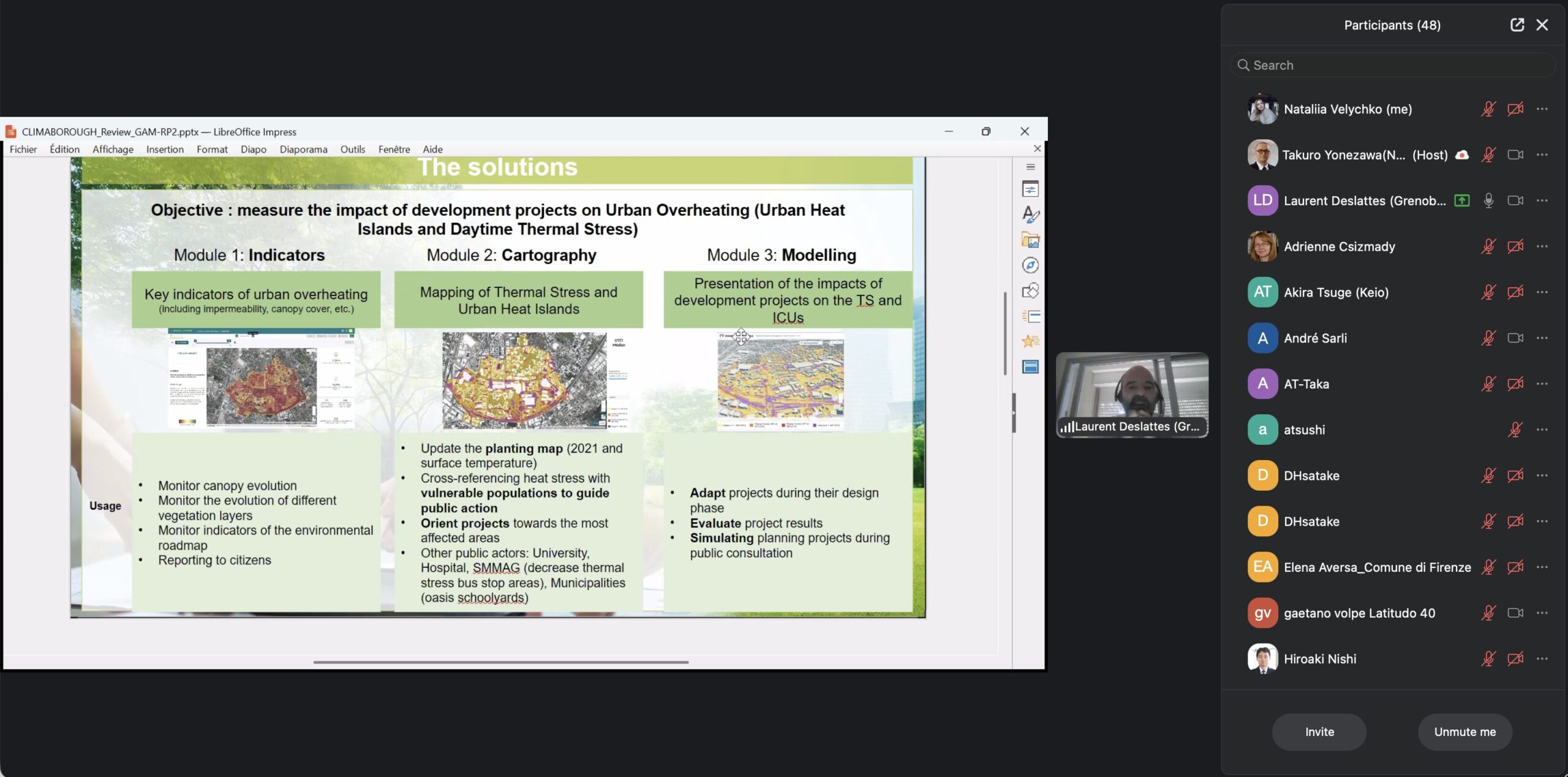
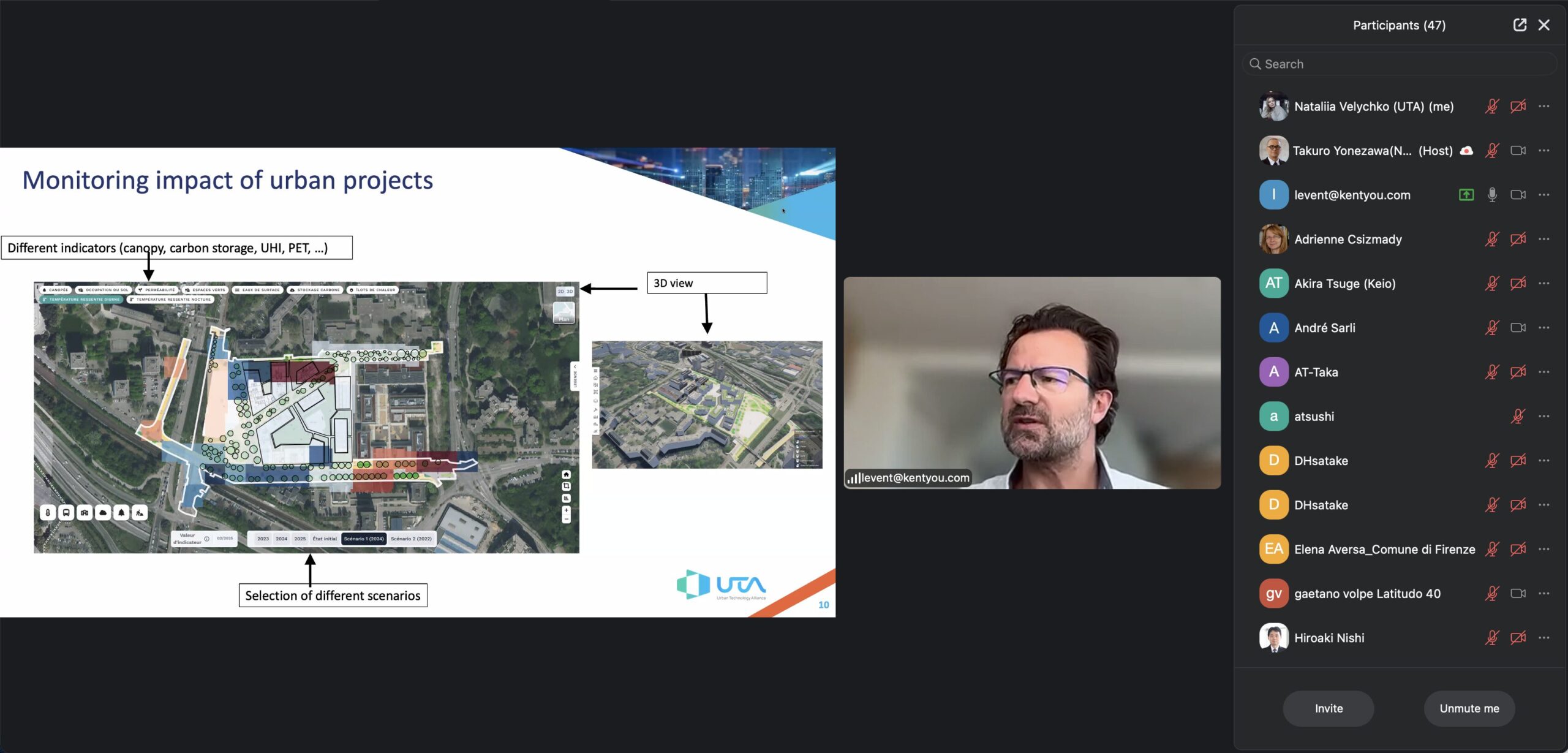
With this data, UTA members Kentyou, Latitudo 40, and RealSim built a decision-support tool for urban planners and technicians. Dr Levent Gürgen said the goal was not only to provide numbers, but also to encourage discussion. The tool gives city departments a shared, evidence-based way to talk about a problem that affects everyone.
“Over four percent of summer deaths in European cities are linked to urban heat islands. Increasing tree cover by about a third could cut local temperatures by more than a degree and prevent roughly one in three of those premature deaths. Our tool lets a planner see that trade-off before deciding — not years later.”
— Dr Levent Gürgen, President of the Urban Technology Alliance and CEO of Kentyou
The tool combines open data with a network of about 150 air-temperature sensors in Grenoble on a single platform (Kentyou). It adds satellite and field data, such as land cover, greenery, carbon storage, and Physiological Equivalent Temperature (Latitudo 40), and displays everything in a 3D digital twin of the city (RealSim). Planners can compare different project options, virtually plant trees to see their effect on heat and carbon and zoom in from the whole city to street level, including areas around schools and other vulnerable groups.
Satellites as a time machine for city managers
Where can cities get reliable data to make better decisions? Gaetano Volpe, CEO of Latitudo 40, says the answer is often found in satellite data high above the Earth.
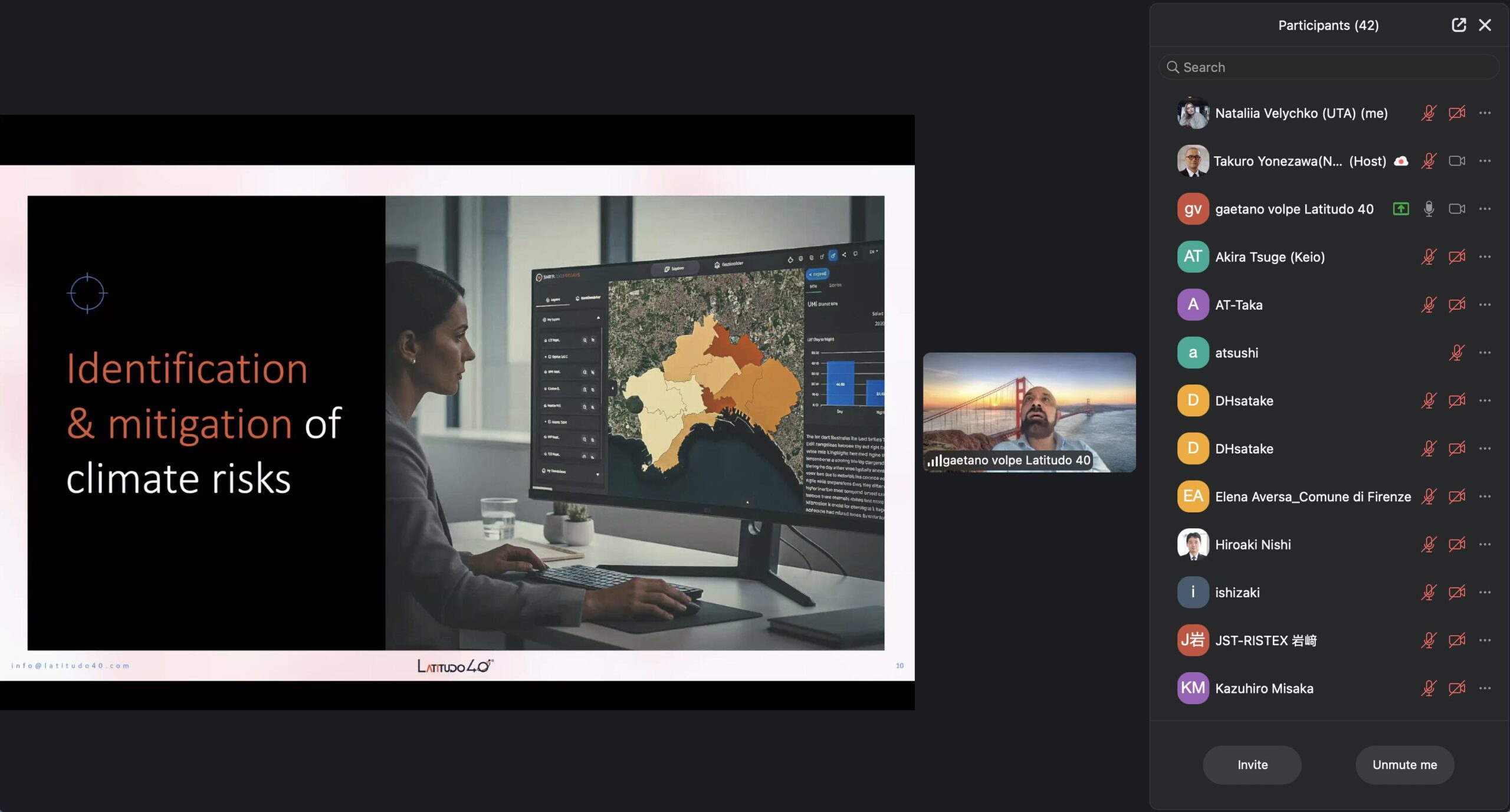
During the webinar, Gaetano Volpe explained how satellite imagery, combined with artificial intelligence, enables cities to understand not only what is happening today but also how urban environments have evolved over time. By analysing raw Earth observation data into useful insights, cities can monitor environmental conditions, assess risks, and test the possible impact of planning decisions before implementing them.
Latitudo 40’s AI-powered platform creates detailed environmental information, such as hourly air quality maps at 25-metre resolution, land surface and perceived temperatures, vegetation health, carbon storage, land-use changes, and flood and road vulnerability assessments. Those insights help city planners make quicker, evidence-based decisions and support climate adaptation.
Gaetano Volpe showed how this technology is making a difference in projects across Europe and beyond. In Benidorm, Spain, the platform cut environmental monitoring costs by about 85%. In Naples, it helped find nature-based solutions that lowered temperatures by around 3°C in some urban areas. Other uses include finding the best spots for green roofs in Gothenburg, simulating climatic scenarios for new districts in Abu Dhabi, and powering a navigation app in Turin that suggests cooler, less polluted walking routes. Today, the solution is used in over 15 countries and works well with GIS platforms and urban digital twins, giving cities a strong base for climate-resilient planning.
From data collection to chance connections in Japan
Dr Takuro Yonezawa, Associate Professor at Nagoya University, shifted the focus from infrastructure to people. He argued that the next step for smart cities is to give data and AI back to citizens to help build stronger human connections. His motivation comes from a public health crisis: social isolation and loneliness.
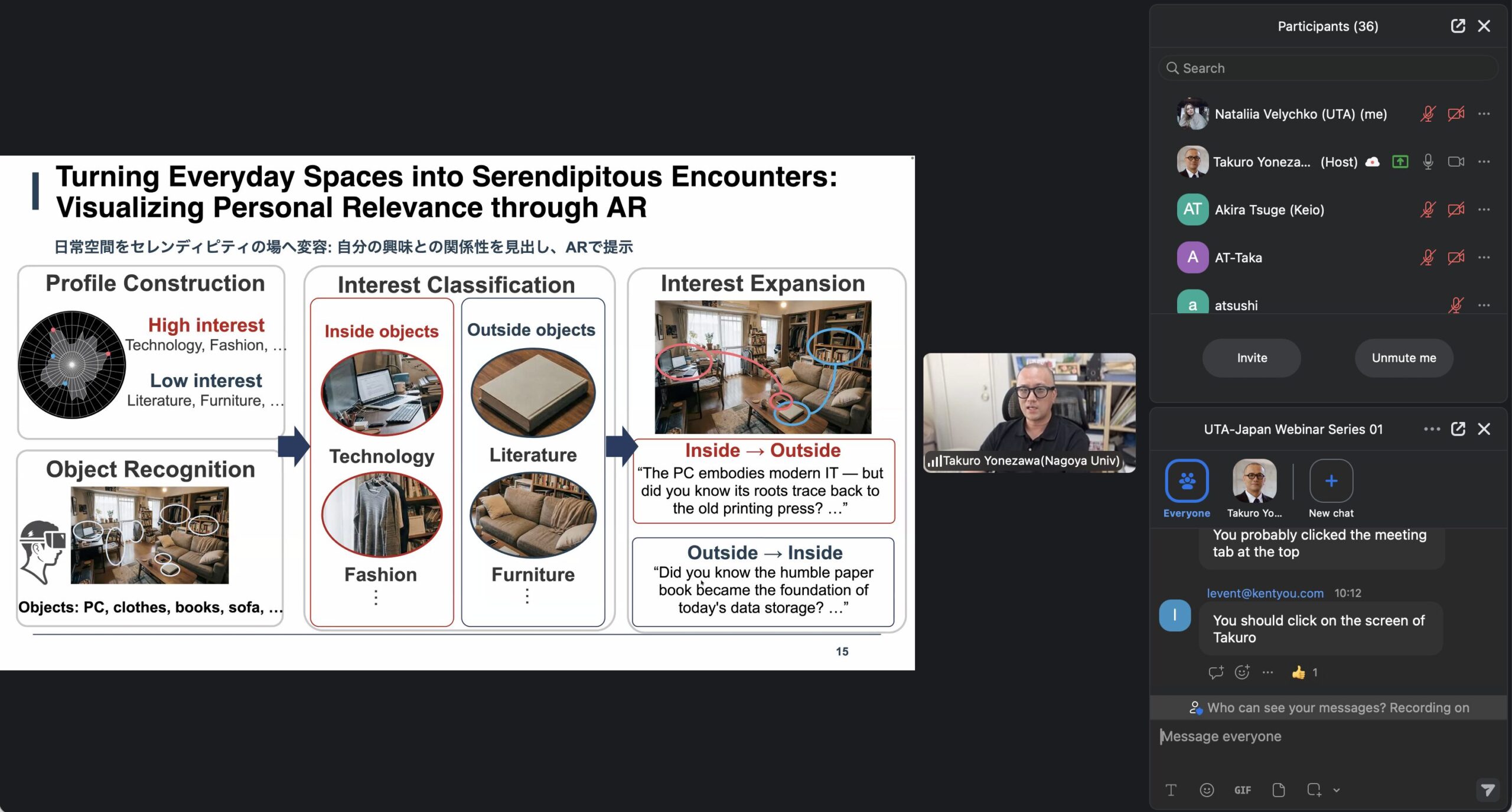
Dr Takuro Yonezawa cited a landmark meta-analysis of 148 studies covering some 300,000 people, which found that those with strong social relationships enjoy roughly 50% higher survival odds, and a Japanese Cabinet Office survey showing a third to a half of the population faces some isolation risk. Policy is catching up: the WHO issued its first major report on the subject in 2025, the UK appointed a Minister for Loneliness in 2018, the US Surgeon General called it an epidemic in 2023, and Japan created its own minister in 2021 and a dedicated law in 2024.
His team’s framework is based on three M’s: Mobility, which is the physical ability to move; Motility, which is a person’s real capacity to use that mobility, including digital skills and feeling safe; and Mattering, which is whether a new person or place feels important to them. Their projects include an urban-space model that shows where chance encounters may happen, AR smart glasses to encourage unexpected meetings, and Community Compass, a public health tool that links personal health data with local information.
Community Compass, now permanently installed at a public health centre in Tokyo’s Toshima Ward, attracted more than 1,000 users in its first two months and over 2,000 across sites in Tokyo, Shizuoka, Kanagawa, and Kyoto. It can also connect to retail point-of-sale data, for example, encouraging new parents to join local childcare groups.
Reading the city through its movement — including in a disaster
Dr Masahiro Mochizuki of JRISS, the Social Systems Research Institute in the Kansai region, ended the case studies with a three-step approach: sensing, analysis, and alliance. This method is designed to use low-cost, existing infrastructure.
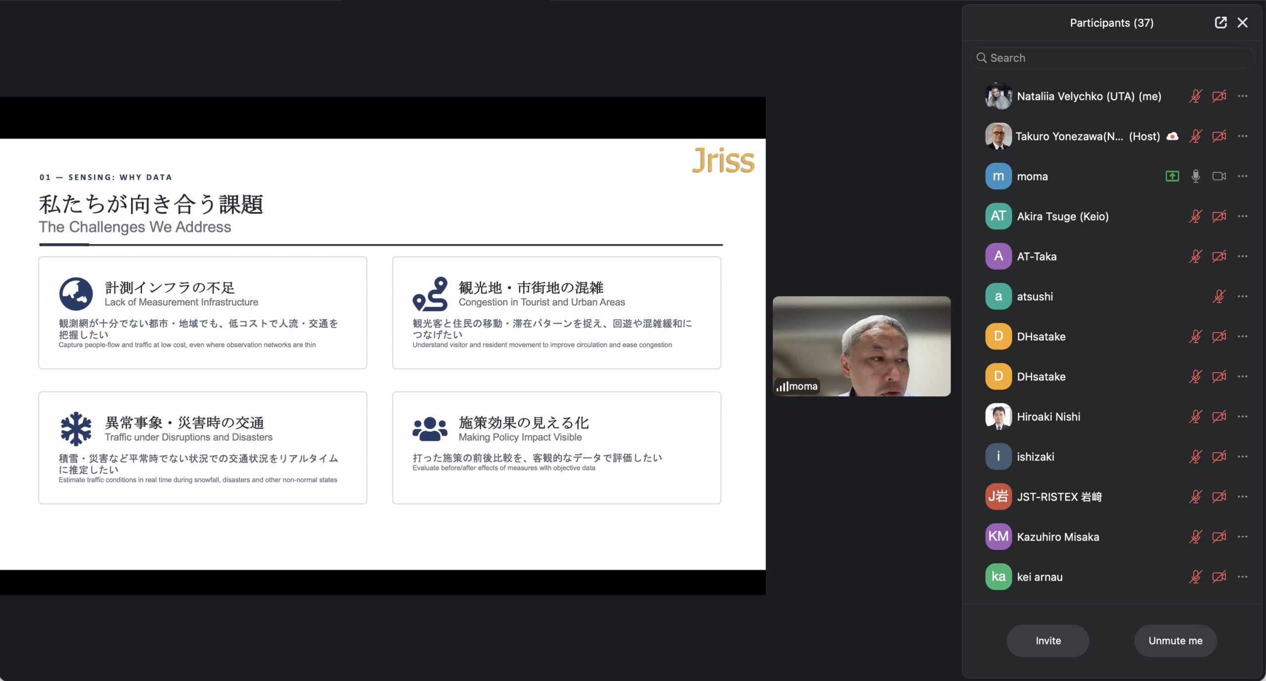
Dr Masahiro Mochizuki’s team collects data on pedestrians, crowds, and vehicles using anonymised Wi-Fi and Bluetooth sensors, AI analysis of camera feeds (for example, counting foot traffic on Kyoto’s Arashiyama Togetsukyo bridge from a public YouTube stream), and private probe data. These methods were used at the Osaka-Kansai Expo 2025 and in projects in Cambodia and Romania. Working with Kyoto University, the team combines traffic data and machine learning to estimate road systems and send congestion alerts. They also use Toyota vehicle-probe signals to measure road slipperiness in snow, turning each car into a road-condition sensor.
The most powerful example came from disaster response. When analysing the Noto Peninsula earthquake on 1 January 2024, Mochizuki showed that traffic data revealed coastal roads filling with movement just 15 minutes after the quake, as residents evacuated ahead of the tsunami. Probe data continued to flow throughout the event.
Following the first session, the next two UTA Café | EU–Japan Webinar Series events will be held in September and October 2026. They will focus on new Horizon Europe and other EU funding opportunities. These sessions will give practical advice on forming international consortia, connecting Japanese and European partners, and turning new ideas into collaborative research and demonstration projects.
Stay connected with the Urban Technology Alliance. Subscribe to the UTA Newsletter for updates on upcoming UTA Café sessions, Horizon Europe funding, member success stories, pilot projects, smart city events, and the latest news in smart and sustainable cities.