Urban planning and infrastructure development require tools capable of representing complex environments and analysing how proposed changes may affect the built environment.
However, planning processes often rely on traditional 2D documents or static models that are difficult for stakeholders to interpret. This can lead to misunderstandings, slower decision-making, and challenges in communicating projects to the public.
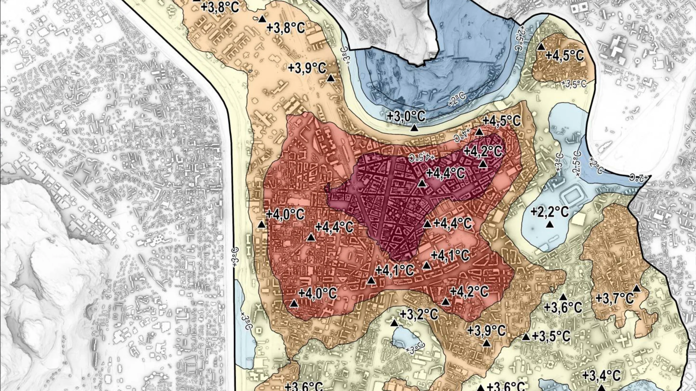
RealSim addresses these challenges through interactive digital twin simulations that combine mapping data, infrastructure models, and simulation technologies into a virtual representation of real environments.
RealSim City is a digital twin solution based on Environment Information Models (EIM) that simulate towns and cities in highly detailed 3D environments. These simulations combine geospatial mapping, architectural data, and engineering information to recreate real urban environments within an interactive digital platform.
The solution enables planners, engineers, and stakeholders to explore cities from multiple viewpoints and analyse the potential impact of new developments before they are built.
By providing immersive visualisation and spatial analysis tools, RealSim City supports better planning decisions and improves communication between developers, authorities, and communities.
RealSim City integrates multiple capabilities for analysing and visualising urban environments.
These capabilities enable cities and developers to assess design options and infrastructure changes before real-world implementation.
RealSim City digital twins are used across multiple planning and infrastructure contexts.
Get in touch to explore deployment opportunities or propose a complementary approach.