
Latitudo 40 is an innovative start-up in the field of Earth Observation, born from the passion, expertise, and experience of a team united by a common goal: to improve the planet through satellite technologies.
Founded in 2017 as a spin-off from the University of Naples Federico II, Latitudo 40 has focused on a challenge from the start: to provide companies, government agencies, municipalities, and urban planners with a highly automated, easy-access cloud platform, powered by cutting-edge artificial intelligence algorithms.
Our technology enables cites to make informed, valid, and sustainable decisions by developing and enhancing the value of an informative heritage of data that encourages the adoption of new operational models based on sustainability and resilience.
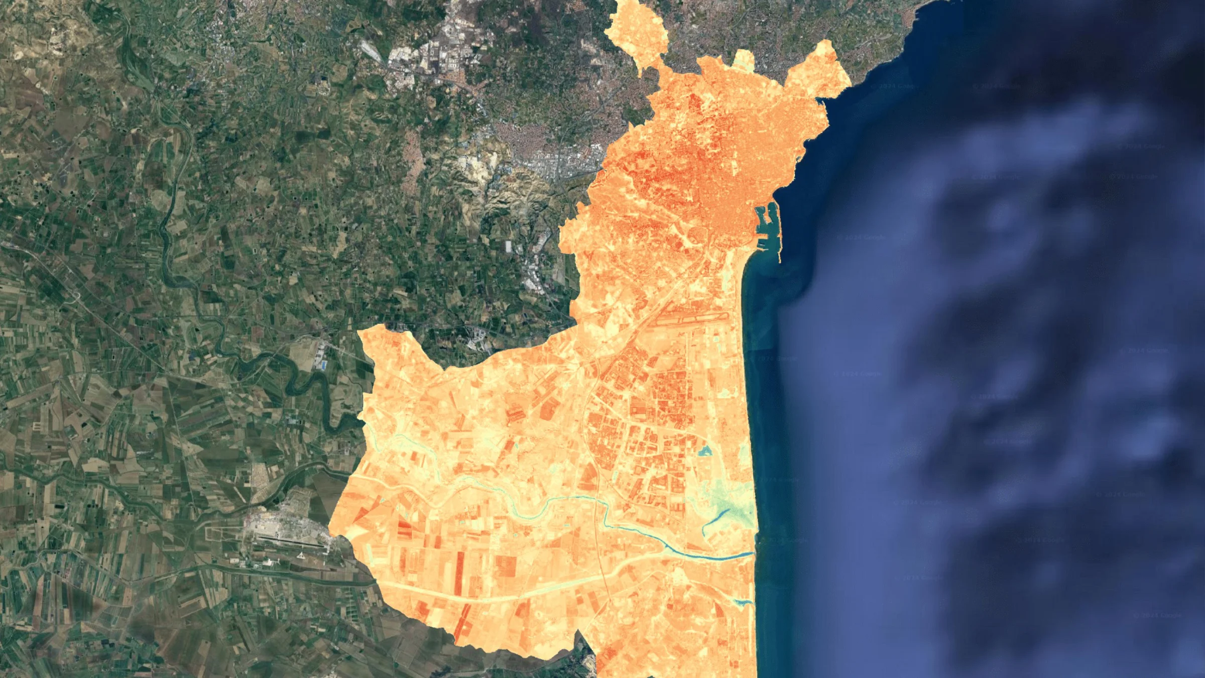
Data from Earth Observation satellites are integrated with contextual data from other sensors and models, such as weather, population distribution, and open data.
Latitudo 40 provides an advanced, datadriven platform to support sustainable and intelligent urban planning. Using a “nosensors” approach based exclusively on satellite imagery and artificial intelligence, the platform enables cities to monitor, analyze, and simulate urban dynamics on a scientific and objective basis.‑driven platform to support sustainable and intelligent urban planning. Using a ‑sensors” approach
The solution helps cities:
By combining Earth observation data with AIbased analytics, Latitudo 40 supports fair, informed, and sustainable decisionmaking, helping urban designers and city authorities address challenges related to land use, climate adaptation, naturebased solutions, building and public space design, and essential services such as transport, water, and energy.‑based analytics, Latitudo 40 supports ‑making‑based solutions, building and public space design, and essential services such as transport, water, and energy.
The platform is built on a flexible, zerocode geospatial analytics architecture, allowing users without technical expertise to create, visualize, and analyze spatial data. It integrates multispectral, radar, and hyperspectral satellite imagery from major global operators, supported by validated, readytouse analytics algorithms tested on largescale, realworld datasets. Advanced visualization tools enable interactive maps, adhoc analysis, and easy integration into enterprise systems via connectors and SDKs.‑code geospatial analytics architecture‑to‑use analytics algorithms tested on large‑scale, real‑world datasets. Advanced visualization tools enable interactive maps, ad‑hoc analysis, and easy integration into enterprise systems via connectors and SDKs.
Latitudo 40 also operates a largescale satellite acquisition and monitoring infrastructure, automatically sourcing, processing, and updating imagery from multiple satellite constellations to ensure continuous, highquality urban monitoring.‑scale satellite acquisition and monitoring infrastructure, automatically sourcing, processing, and updating imagery from multiple satellite constellations to ensure continuous, high‑quality urban monitoring.
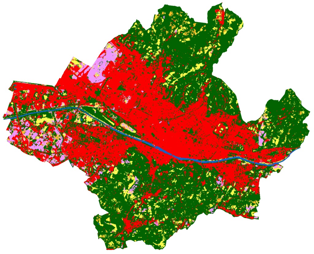
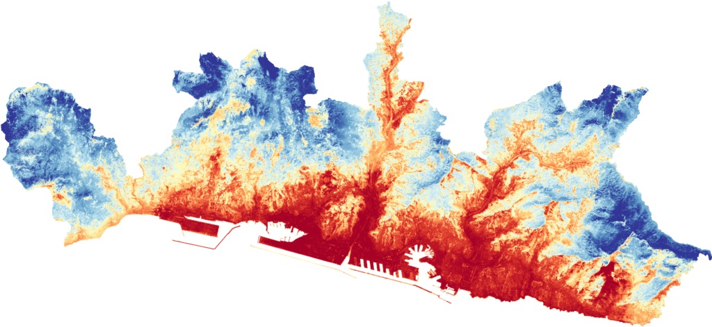
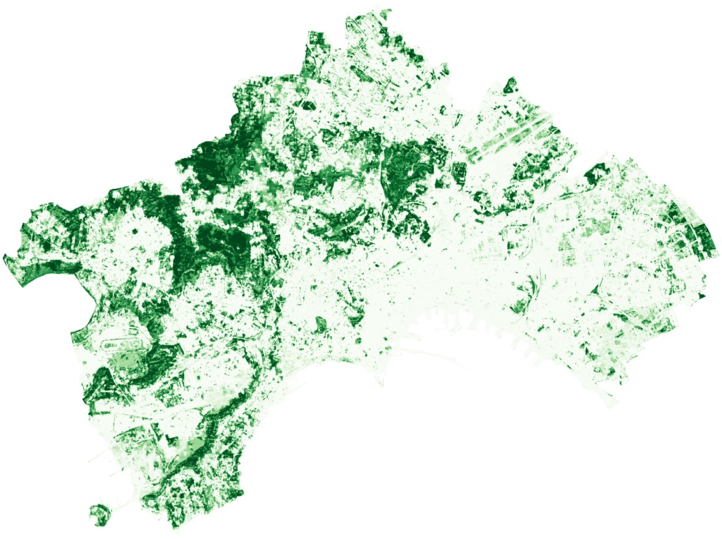
Key example data products include:
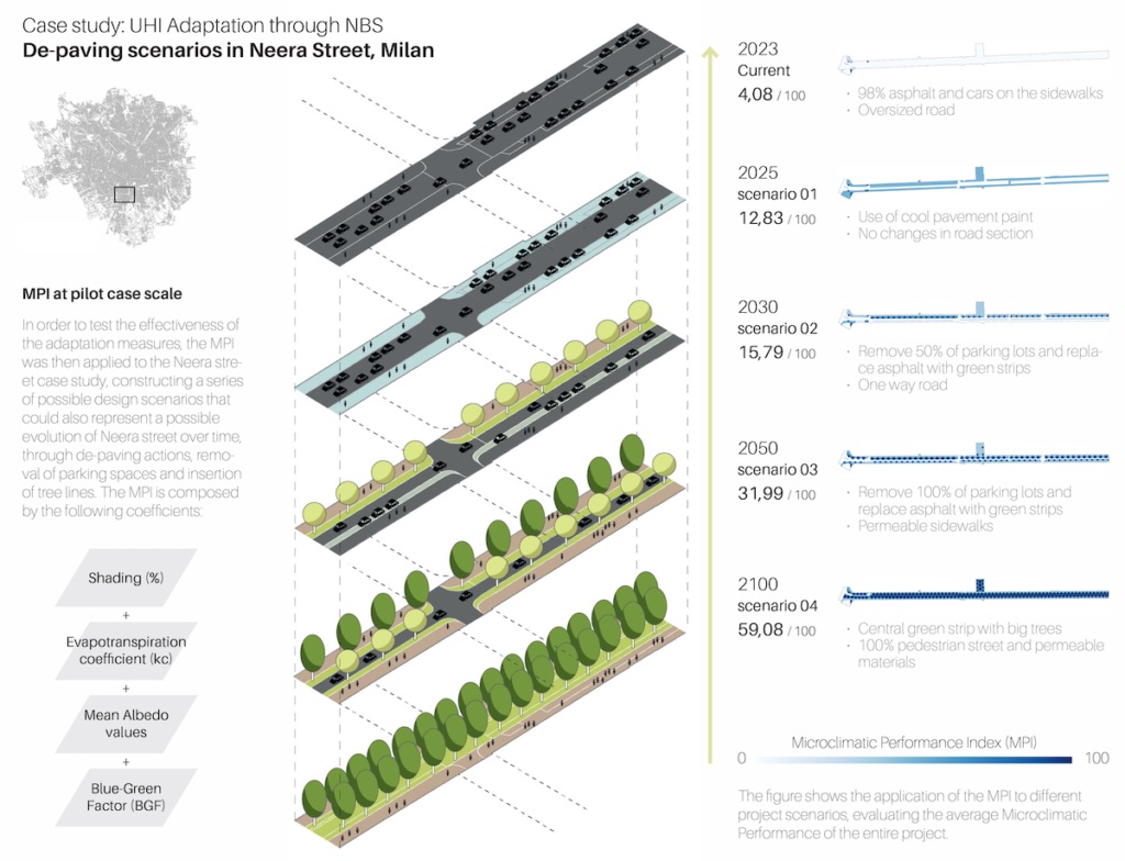
In addition, the Latitudo 40 Place Simulator is a tool capable of simulating and evaluating future urban scenarios using exclusively satellite images. It allows you to objectively compare design and strategic alternatives in order to evaluate the best one. It therefore allows you to test urban solutions in a virtual way, thus avoiding very expensive and time-consuming modifications and field tests, measuring the environmental benefits and the impact on the area under consideration. Latitudo 40 Place Simulator significantly supports urban planning and the sustainable management of cities and territories.
In summary, Latitudo 40 equips cities and urban planners with a scientifically grounded, scalable, and sustainable digital toolkit to guide urban transformation and prepare cities for future environmental and societal challenges.