
RealSim is an Irish technology company specialising in interactive 3D simulation, digital twins, and immersive technologies applied to the built environment. Established in 2008, the company was among the first in Ireland to provide the planning and development sector with geospatial interactive 3D environment models, now widely known as digital twins.
RealSim develops highly accurate virtual representations of cities, landscapes, and infrastructures by combining aerial mapping data, architectural and engineering information, and advanced simulation technologies. These digital environments allow stakeholders to visualise and analyse how urban or environmental changes may affect a territory before they are implemented in reality.
The company works with a wide range of stakeholders involved in the built environment, including planning authorities, architects, developers, engineers, and infrastructure operators. Through its simulations and modelling services, RealSim enables both technical and non-technical audiences to better understand development proposals and environmental changes, improving decision-making and reducing uncertainty during planning processes.
RealSimâs mission is to modernise planning and development processes by using immersive digital technologies to represent real environments and simulate future changes.
Through digital twins, virtual reality environments, and simulation tools, the company seeks to help organisations explore potential scenarios, analyse environmental impacts, and communicate complex spatial information in an intuitive and accessible way.
By enabling stakeholders to visualise projects and environments before they are built, RealSim contributes to more transparent planning processes, improved collaboration between stakeholders, and better-informed urban and infrastructure decisions.

RealSim focuses on several challenges frequently encountered in urban planning and infrastructure development:
Traditional planning processes rely heavily on 2D drawings and technical documentation, which can make it difficult for stakeholders and citizens to understand the spatial implications of proposed developments.
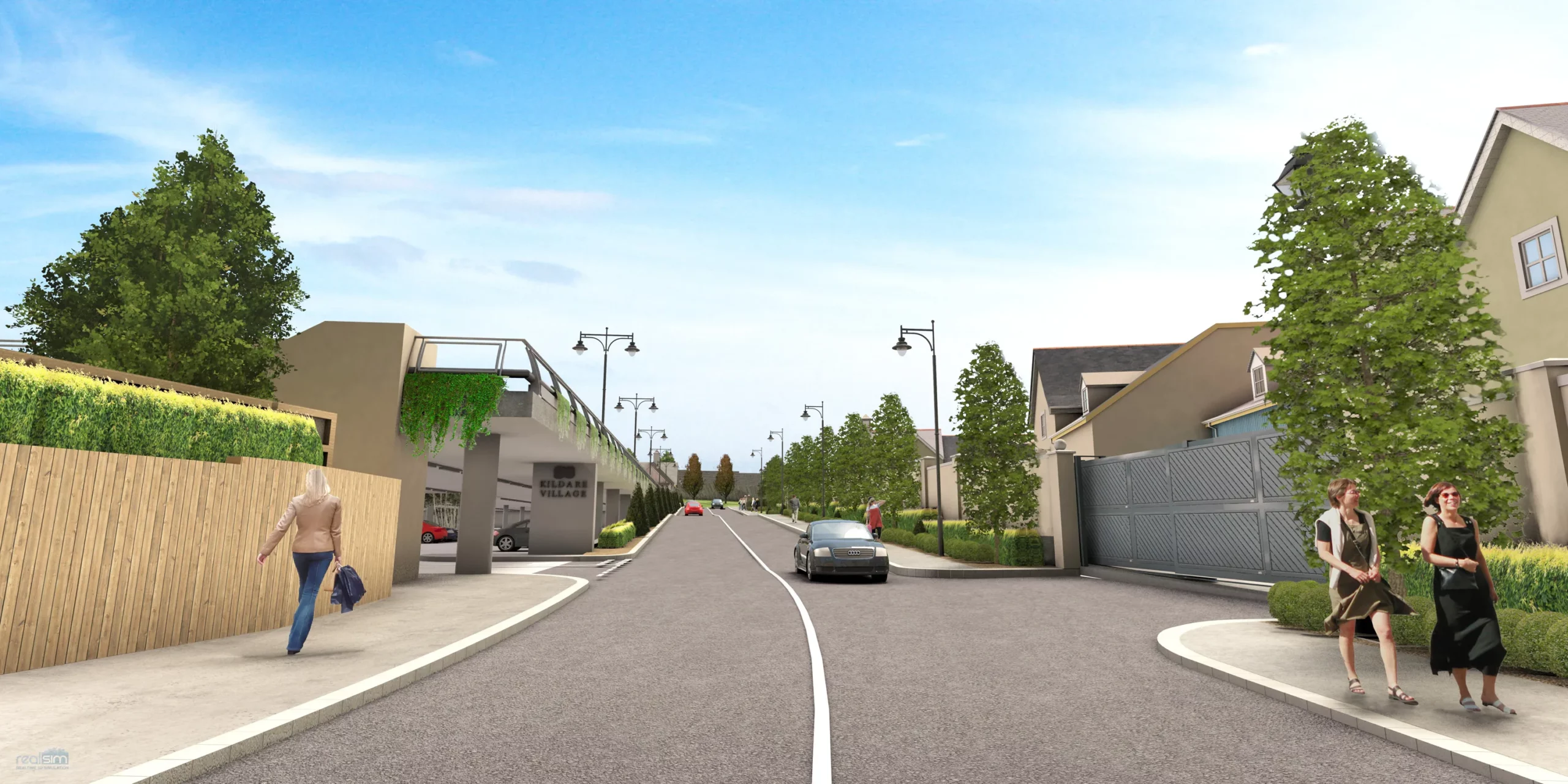
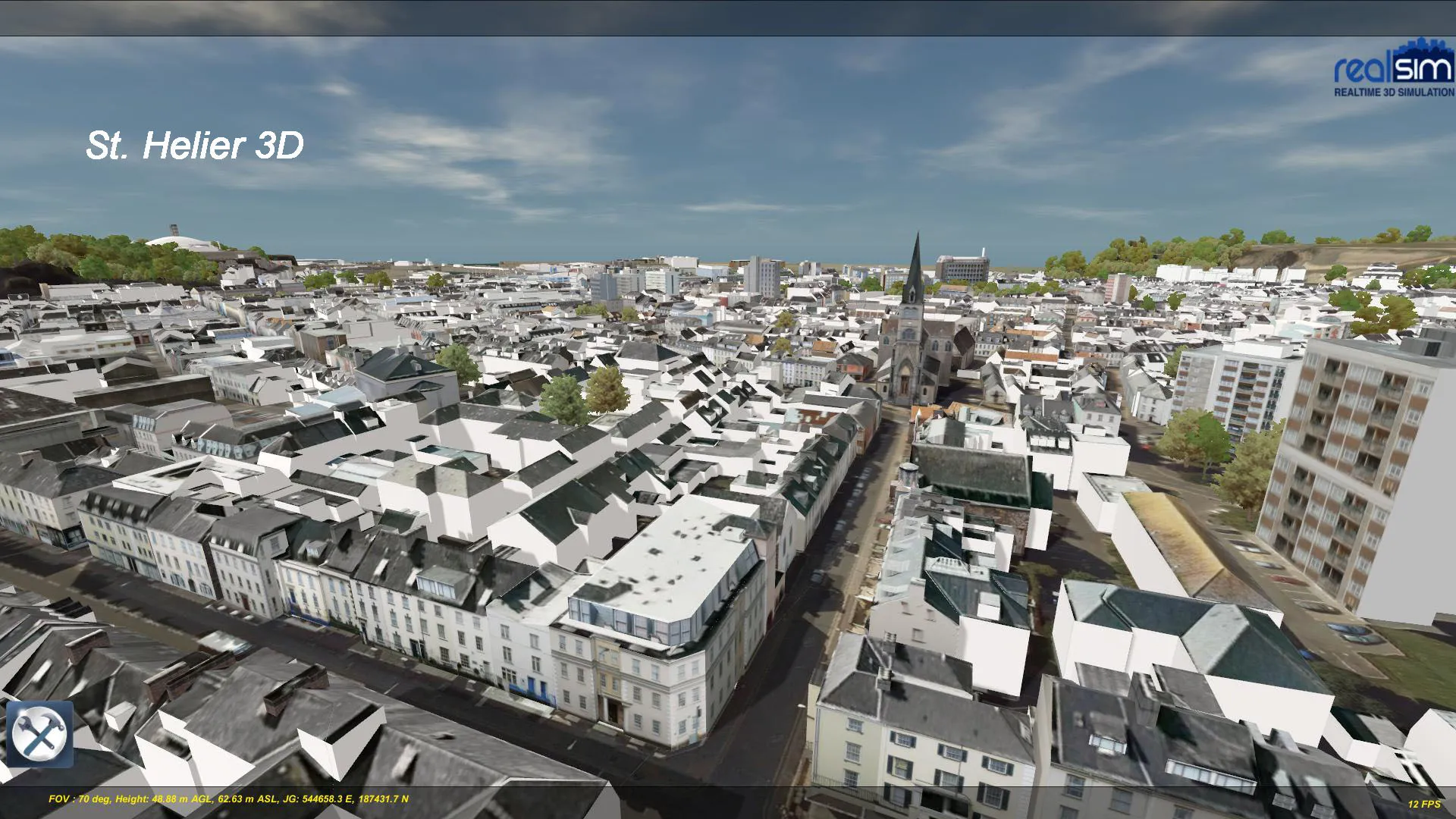
RealSim develops Environment Information Models (EIM) and immersive simulations that combine mapping data, engineering information, and real-time rendering technologies to create detailed digital twins of urban or natural environments.
These models allow users to explore environments from multiple perspectives, analyse spatial and lighting conditions, and simulate the effects of future changes before implementation.
These solutions enable planners, engineers, and decision-makers to evaluate scenarios and communicate projects more effectively with stakeholders and the public.
RealSimâs digital twin and immersive technologies have been used in urban planning, heritage reconstruction, marine infrastructure modelling, and public consultation initiatives.
One notable example is the collaboration with Fingal County Council in Ireland, where RealSim developed immersive 3D models and virtual reality tools to support public engagement in planning projects. The initiative included Irelandâs first publicly accessible 3D web viewer for a local authority and VR-based planning consultations allowing citizens to explore proposed developments in detail.
These immersive tools help improve public understanding of development proposals and support more transparent planning processes.